Lower Muley Twist Canyon
What to Expect
Safety Advisory
Flash floods are the real danger here. The canyon drains a massive area, and storms miles away can send a wall of water through with almost no warning. Check weather forecasts obsessively before entering, and never hike this canyon if there's any chance of rain within 50 miles.
Route-finding can be tricky, especially where side canyons branch off the main wash. GPS tracks downloaded beforehand are strongly recommended — cell service is nonexistent, and the canyon walls all start to look alike after a few hours.
Summer temperatures in the canyon can exceed 100 degrees, and the sandy wash bottom reflects heat back at you from every direction. Late spring and fall are far more forgiving; midwinter days are short but often perfect for hiking.
Trail Details
Pro Tips
Set up a car shuttle between the Post trailhead and the Burr Trail Road access to turn this into a one-way through-hike instead of doubling back — it cuts the day from grueling to manageable and lets you see the entire canyon.
Carry all your water; there are no reliable sources in the canyon. Plan for at least four liters per person in cooler months, more if temperatures climb above 80 degrees. The nearest fill-up is back at the visitor center.
The best light for photography hits the narrow sections mid-morning when sunbeams slice into the canyon — position yourself in the tighter stretches between miles two and four for those glowing sandstone walls that make Capitol Reef famous.
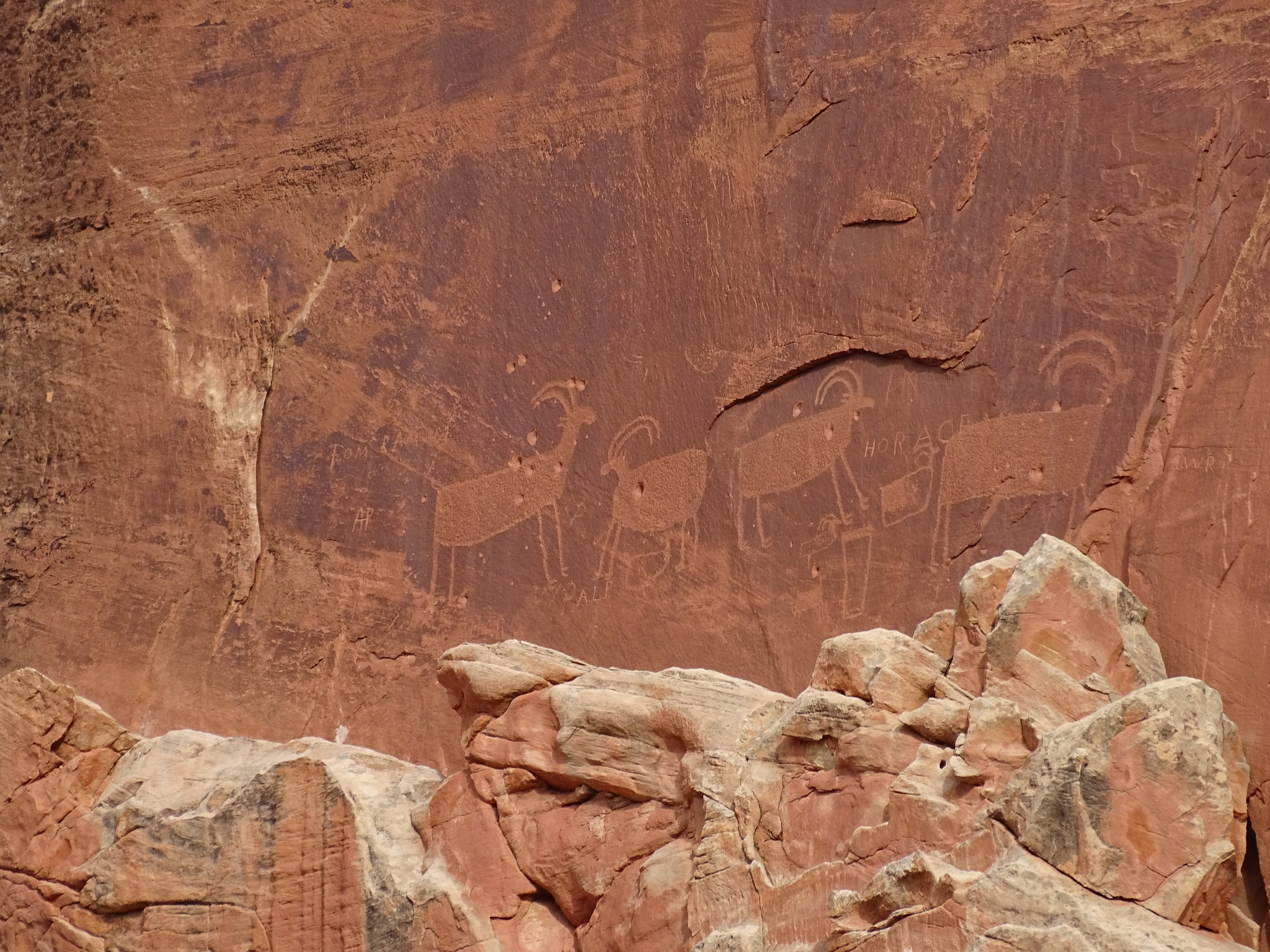
Photos
 NPS
NPS