Lake George & Gobblers Knob Trail
What to Expect
Safety Advisory
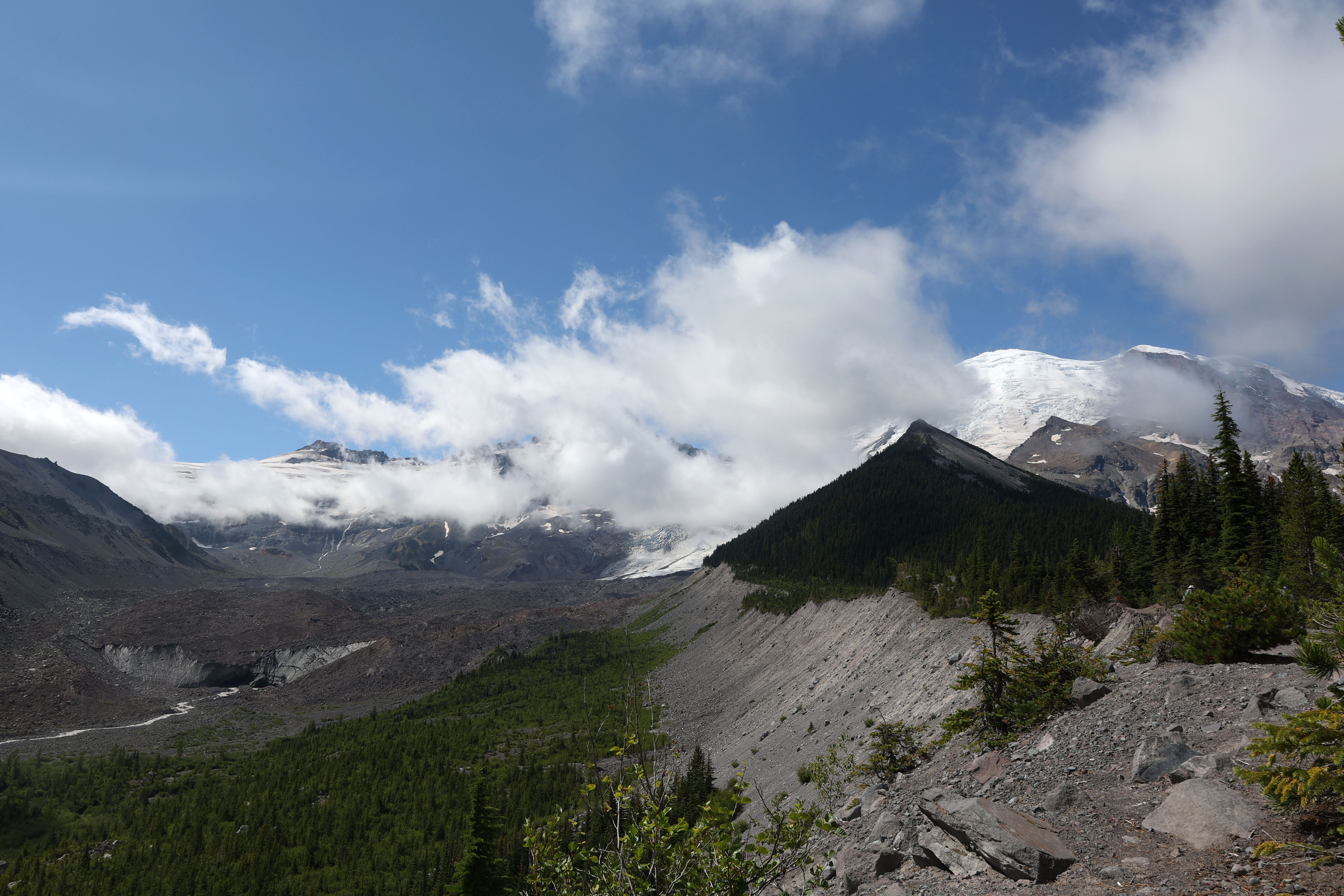
Snow lingers on the upper reaches toward Gobblers Knob well into July most years — the final switchbacks can be treacherous when icy, and route-finding gets tricky when the trail is buried under snowpack.
The Westside Road area sees regular black bear activity, particularly in berry season from late July through September — carry bear spray and make noise on blind corners through the forest sections.
Trail Details
Pro Tips
Do the loop by hitting Lake George first, then continuing to Gobblers Knob — you'll get the hardest climbing done while you're fresh, and the lake makes a better rest stop on the way back down.
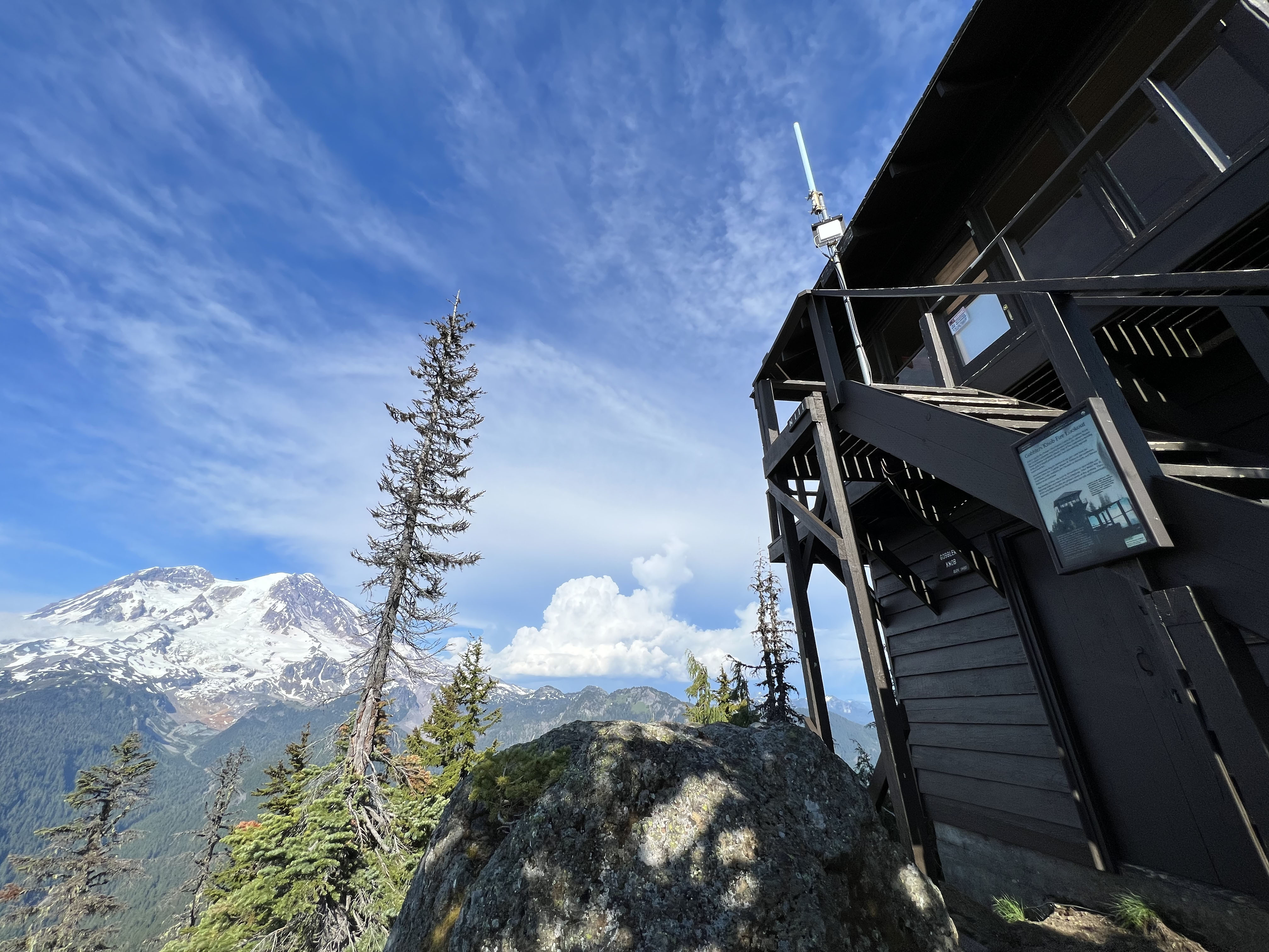
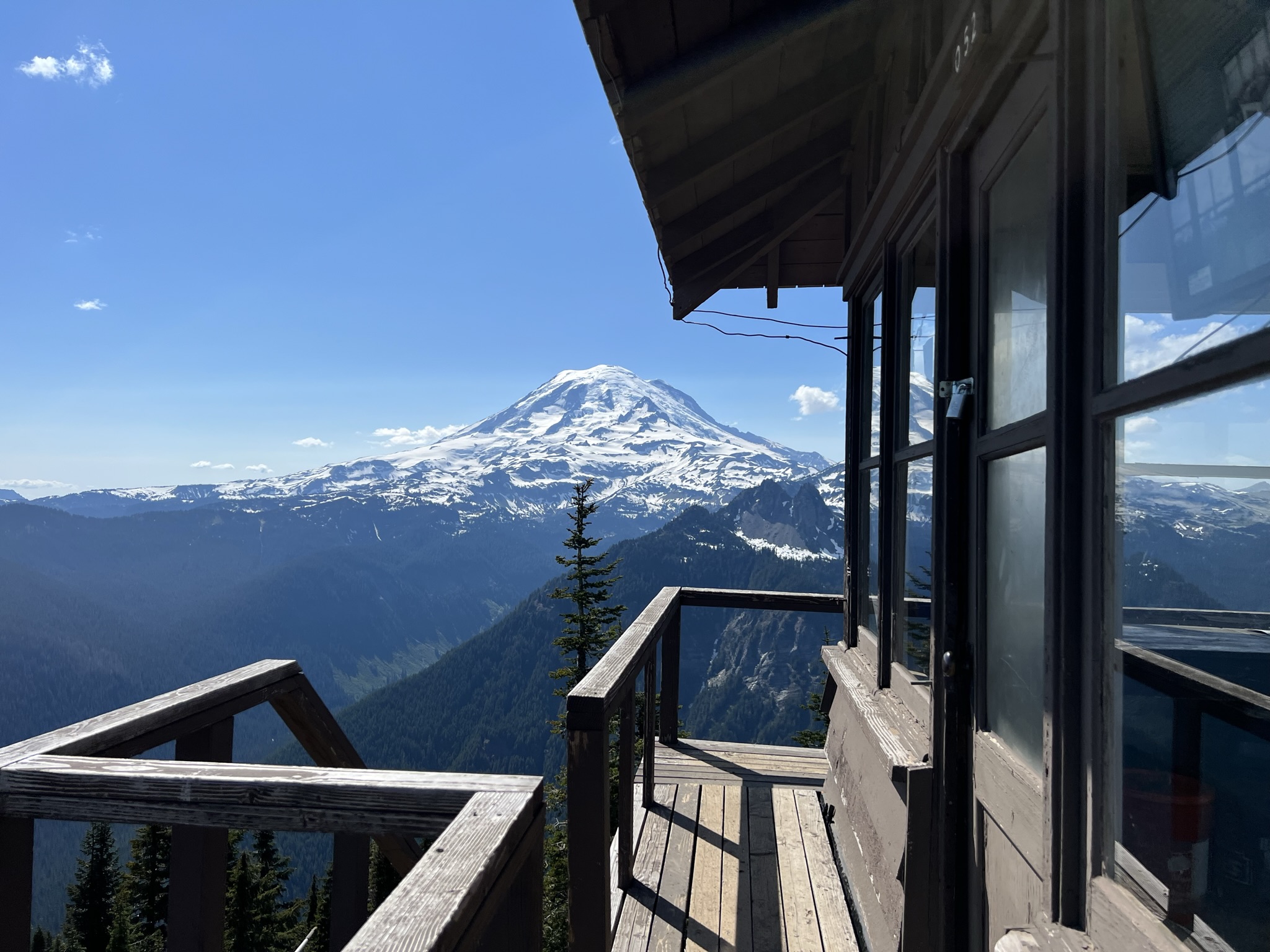
The fire lookout at Gobblers Knob is one of the best places on the mountain's west side to photograph Rainier without crowds — arrive before mid-morning when clouds typically start building around the summit.
The Westside Road that leads to the trailhead is frequently closed to vehicle traffic due to washouts — check current road status with the ranger station before driving out, or be prepared to add several miles of road walking each way.
More Trails in Mount Rainier
Hike to Gobblers Knob Fire Lookout
Hike to Shriner Peak Fire Lookout
Hike to Silver Falls