Pacific Crest Trail
What to Expect
Safety Advisory
Early-season stream crossings can run thigh-deep with snowmelt, especially in June and early July. Trekking poles and unfastened hip belts are essential at fords — the current is stronger than it looks.
The trail crosses exposed ridgelines with no shelter from lightning. Afternoon thunderstorms roll in fast on the east side of Rainier, so plan to be off high points by early afternoon during summer months.
Trail Details
Pro Tips
Park a second car at the Laughingwater Creek trailhead for a one-way shuttle hike — otherwise you're doubling back on the same trail, and the logistics of an out-and-back on a linear trail get old fast.
Chinook Pass doesn't open until late May at the earliest, and snow lingers on north-facing sections well into July. Check the WSDOT Chinook Pass status page before driving out — the gate closure gives zero warning and there's no cell service to check on the road.
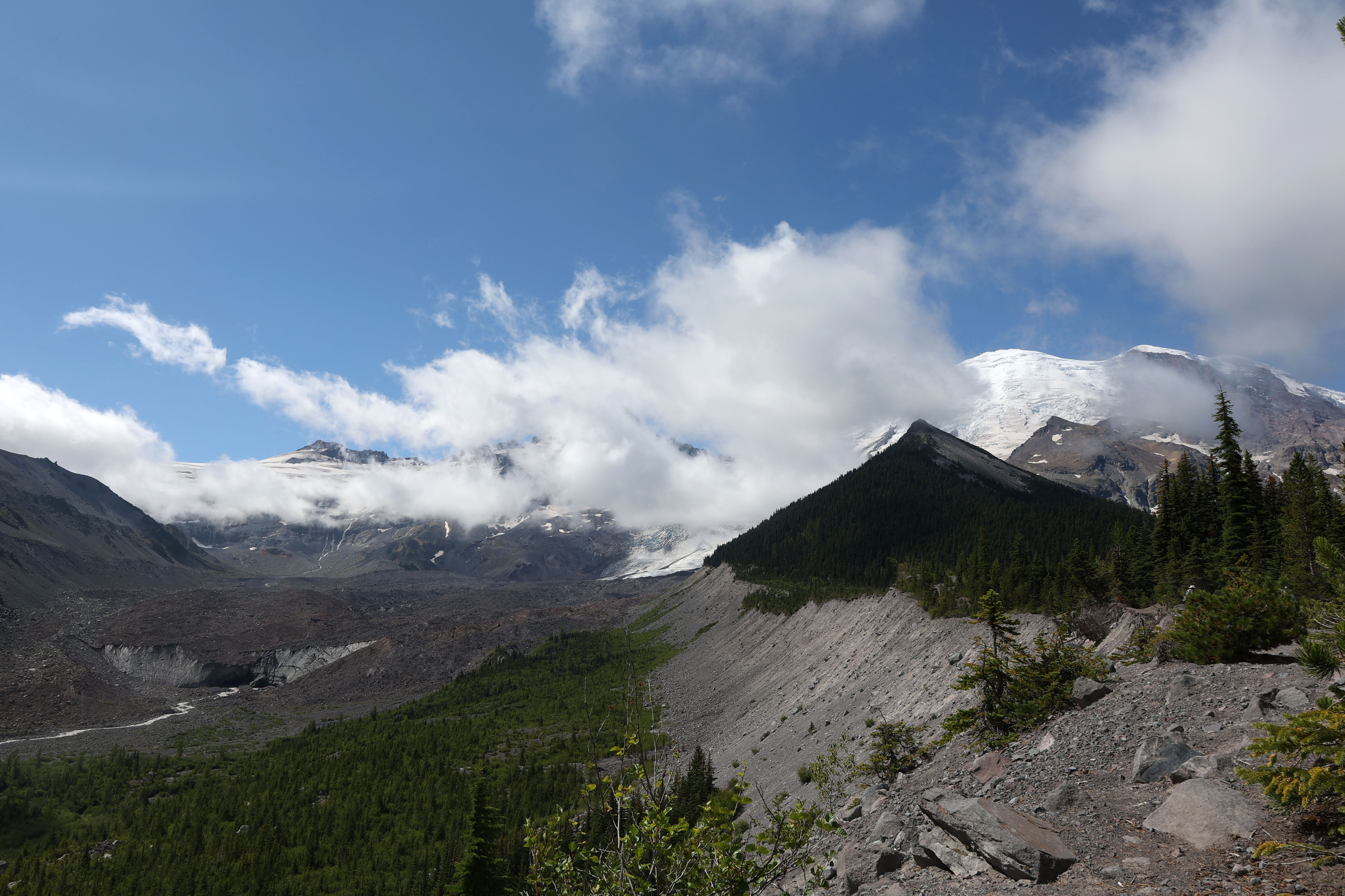
The section near Dewey Lake, about three miles south of Chinook Pass, offers one of the best wild camping spots along the PCT in Washington — flat ground, reliable water, and a view of Rainier's east face that most photographers never see because they're all pointing their cameras from Reflection Lakes.
More Trails in Mount Rainier
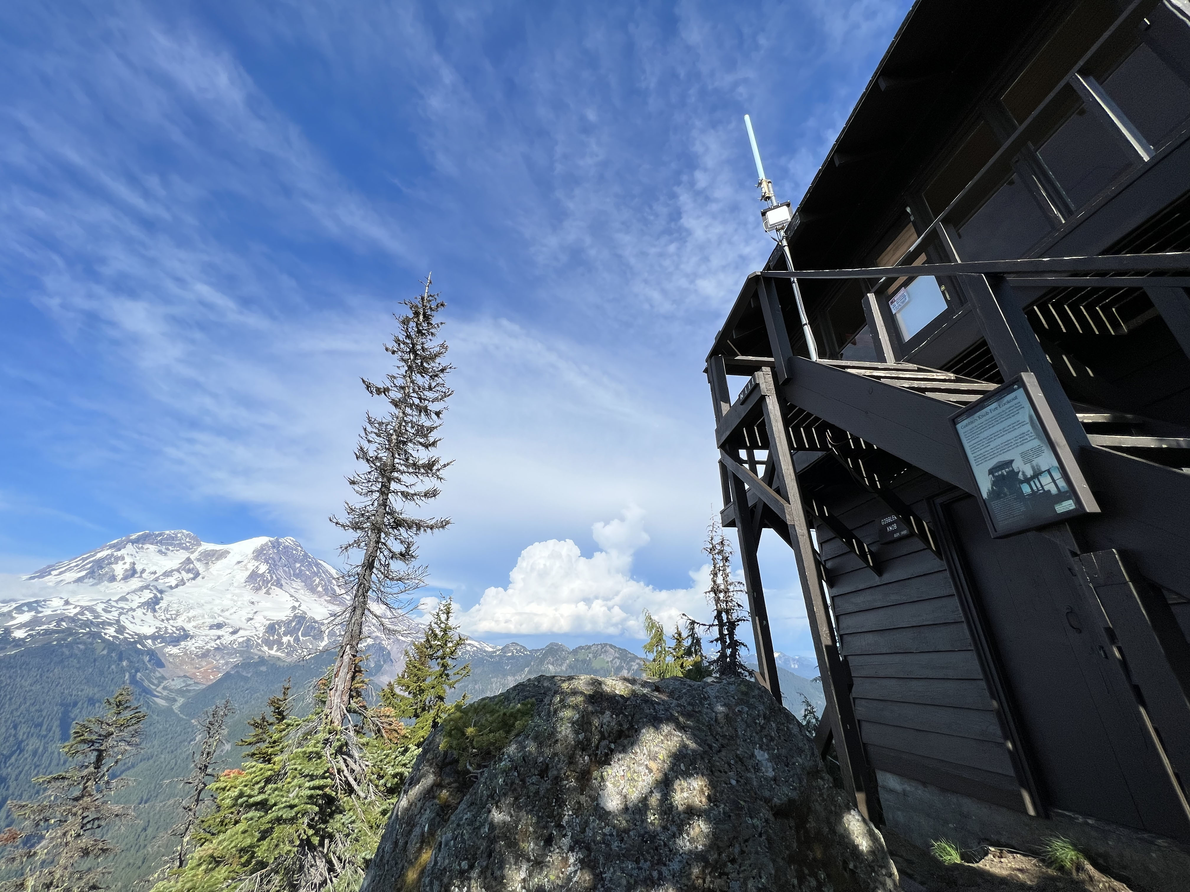
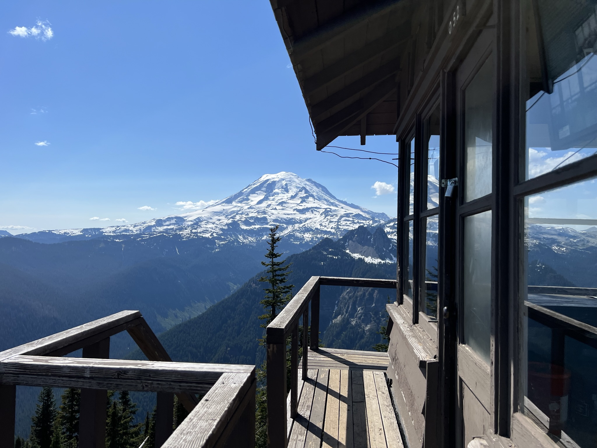
Hike to Gobblers Knob Fire Lookout
Hike to Shriner Peak Fire Lookout
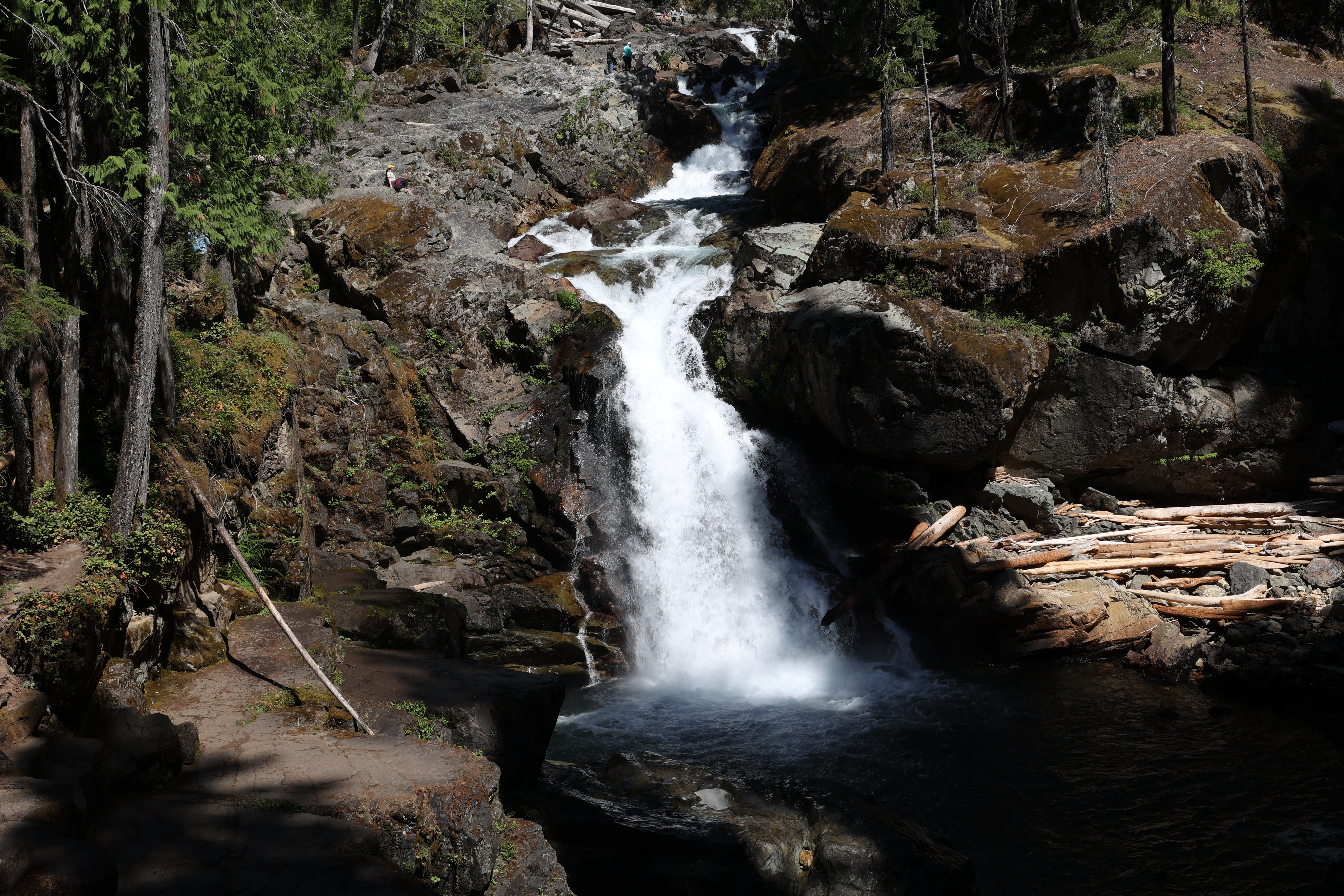
Hike to Silver Falls