7 parks with working ranches and historic farms
Seven parks where pioneer orchards, homestead cabins, and working farms share space with protected wilderness
Most national parks preserve wilderness. A handful also preserve the work of homesteaders, ranchers, and farmers who carved lives out of that wilderness before the boundaries were drawn. These seven parks let you walk through orchards planted a century ago, explore barns that still smell like hay, and watch bison graze on the same grasslands that supported cattle drives. The combination isn't common: working landscapes and protected ecosystems rarely coexist this well.
June brings the harvest season to several of these parks, when fruit ripens in historic orchards and ranger programs shift from geology talks to agricultural demonstrations. The farms aren't museum pieces. You can pick cherries in Utah, watch sheep graze in the Smokies, and bike past dairy barns in Ohio that predate the park itself.
Capitol Reef National Park
Mormon orchards beneath a hundred-mile wrinkle of sandstone / Crowded but the space absorbs it
The Fruita Historic District feels like a mirage tucked into the red rock canyon country. Settlers planted 2,700 fruit trees here in the 1880s, and the Park Service still maintains them. You can walk through orchards of apricot, peach, pear, and cherry trees, then pick whatever's in season from late June through October. The harvest schedule gets posted at the visitor center, and you pay by the pound on the honor system. Hickman Bridge Trail starts just uphill from the orchards, so you can combine a morning hike through sandstone arches with an afternoon filling a bag with Elberta peaches.
Fruita's orchards are the only place in the park system where you can legally pick the fruit that grows wild around pioneer homesteads.
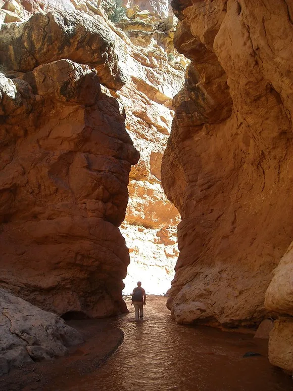
The Gifford Homestead still operates as a cultural demonstration site, with rangers baking fruit pies in the original kitchen and selling them by the slice. The barn, blacksmith shop, and schoolhouse sit along a short loop trail that gets packed in summer, but the crowds thin dramatically once you head into the backcountry washes. Grand Wash Trail cuts through a narrow canyon just north of the orchards, and on weekday mornings in June you'll have the slot to yourself while everyone else fights for parking at the visitor center.
Great Smoky Mountains National Park
Cades Cove preserves an entire valley of farmsteads / The most-visited park in the system
Cades Cove is an eleven-mile loop road through a valley where dozens of families farmed, raised livestock, and built churches before the park was established in 1934. The Park Service maintains the cabins, barns, grist mills, and churches exactly as they stood when the last residents left. Cable Mill still grinds corn on weekends from May through October, and you can watch blacksmith demonstrations at the Becky Cable House. The loop road closes to cars until 10 AM on Wednesday and Saturday mornings from May through September, turning the valley into a bike-only corridor where you can actually hear the creeks and see deer grazing in the fields.
Cades Cove is what the entire Appalachian backcountry looked like before reforestation: open meadows, split-rail fences, and mountains rising beyond the tree line.
The Primitive Baptist Church and Methodist Church still hold services once a year, and the cemeteries tell the story of families who lived here for generations. If you want to escape the car traffic, Abrams Falls Trail branches off the loop road and follows a creek five miles to a 20-foot waterfall. The trail sees a fraction of the crowds that pack the main valley, and the forest closes in quickly enough that you forget you're in the most-visited park in the country. June brings wildflowers to the meadows and enough water flow to make the falls worth the hike.
Cuyahoga Valley National Park
Five working farms within park boundaries / Manageable crowds even in peak season
Cuyahoga Valley wraps around private inholdings and active farmland in a way that makes the park feel more like a greenway than a wilderness. The Countryside Farmers' Markets operate at Howe Meadow and Boston Mill from June through October, selling produce grown on five farms that lease land from the Park Service through the Countryside Initiative. You can bike the Ohio & Erie Canal Towpath past fields of corn and tomatoes, stop at a farm stand for strawberries in June, and keep riding to Brandywine Falls without ever leaving park land. It's the only national park where you can buy CSA shares from farms inside the boundary.
The farms aren't historical exhibits; they're working operations that happen to sit between the visitor center and the waterfalls.
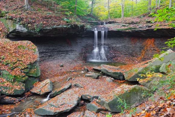
Hale Farm & Village operates as a living history museum just outside the park's northern section, demonstrating 19th-century farming techniques with costumed interpreters. Inside the park, the farmhouses along Riverview Road still house farmers who grow vegetables for Cleveland restaurants and farmers' markets. The juxtaposition feels strange at first, pedaling past a dairy barn on your way to hike Ledges Trail, but it's exactly what the park was designed to do: protect the rural corridor between Cleveland and Akron before it disappeared under suburban sprawl.
Theodore Roosevelt National Park
Bison where cattle ranches once sprawled / Severely underrated and uncrowded
Roosevelt came to the Dakota Badlands in 1883 to run cattle on the Little Missouri River grasslands, and the park preserves both his Maltese Cross Cabin and the Elkhorn Ranch site where he processed the grief of losing his wife and mother on the same day. The South Unit's Scenic Loop Drive passes through prairie that looks identical to the rangeland Roosevelt described in his journals: buttes rising from grass, wild horses on the ridgelines, and bison herds that replaced the cattle when the ranches were bought out. The North Unit is even quieter, with fewer visitors and more opportunities to watch bison up close from pullouts along the road.
This is the park that made Roosevelt a conservationist: harsh, unforgiving, and so open it forced him to reckon with what wilderness meant.
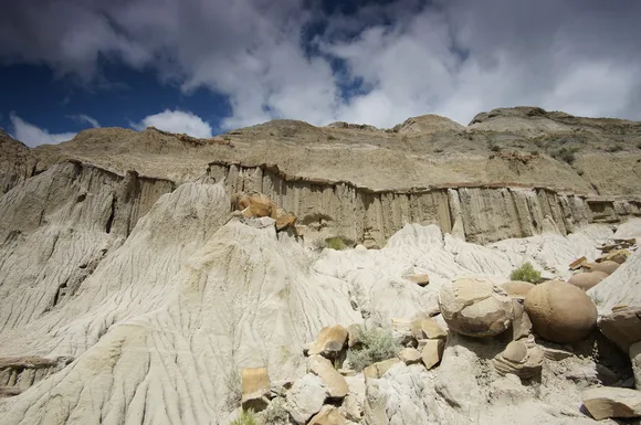
The park still partners with ranchers on the boundaries, and you'll occasionally see cattle grazing just outside the fence line. The contrast is deliberate: the Park Service wants you to understand what these grasslands looked like under ranching pressure versus what they look like now, with native species restored and predators slowly returning. Buckhorn Trail in the South Unit cuts through a former ranch site where you can still see the foundation of a homestead cabin, and the six-mile loop is empty enough that you'll likely have the badlands to yourself.
Gateway Arch National Park
Smaller than many city blocks / Urban park with frontier exhibit halls
Gateway Arch isn't a working farm, but the Museum of Westward Expansion underneath the monument tells the story of how agriculture drove American expansion into the territories. The exhibits focus heavily on homesteading, with displays on sod houses, wheat farming on the Great Plains, and the Homestead Act that distributed 270 million acres of public land to settlers. The Old Courthouse across the street hosted land claim disputes and trials that shaped how the government allocated farmland to homesteaders. It's the historical context for every other park on this list: the legal and cultural framework that put farmers in places like Capitol Reef and the Smokies before those places became protected.
The Arch celebrates westward expansion without glossing over the fact that homesteading was a land grab built on displacement.
The park's riverfront location along the Mississippi ties directly to the agricultural commerce that funded St. Louis in the 19th century: grain shipments, livestock transport, and the trade networks that connected prairie farms to eastern markets. You won't see orchards or barns here, but the interpretive programs explain how federal land policy created the farming landscapes preserved at Theodore Roosevelt and Cuyahoga Valley. June brings the fewest crowds, before summer vacation traffic packs the tram line to the top of the Arch.
Hot Springs National Park
Historic bathhouses meet Ouachita Mountain trails / Packed during peak season
Hot Springs doesn't preserve working farms, but the park's origins as a health resort created a unique agricultural economy in the surrounding valleys. Farmers grew vegetables and raised dairy cattle specifically to supply the bathhouses and hotels that drew health seekers to the thermal springs. The park's trail system climbs into the Ouachita Mountains, where you can still find the foundations of homesteads that supplied the resort trade. West Mountain Trail passes several of these sites on the way to Mountain Tower, and the forest has reclaimed most of the clearings where gardens once grew.
Hot Springs is the only park that started as a spa town and ended up preserving the mountains that surround it.
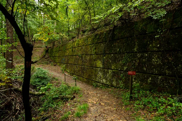
The park's interpretive programs focus on the bathhouse era, but ranger-led hikes occasionally highlight the agricultural history that supported the town. Gulpha Gorge Trail follows a creek where farmers once grew vegetables in terraced gardens, and the CCC-built stone walls still line parts of the path. June brings oppressive heat to the valleys, but the forest canopy on the mountain trails keeps temperatures tolerable. The bathhouses themselves still operate, and you can soak in the same thermal water that attracted settlers in the 1830s.
Acadia National Park
Carriage roads past stone walls and pastures / Packed in summer, quieter in June
Acadia's carriage roads were built by John D. Rockefeller Jr. to connect the island's farms and villages before the park was established. The 45 miles of crushed stone roads still pass through landscapes that look more pastoral than wild: stone walls dividing former pastures, clearings where barns once stood, and stretches of forest that were farmland a century ago. The Park Loop Road skirts the Jordan Pond House, a restaurant that started as a farm serving tea to carriage tourists in the 1890s. You can still get popovers there, though the crowds in summer turn the experience into a theme park version of genteel Maine.
Acadia is built on land that was farmed, logged, and developed before wealthy conservationists bought it back and handed it to the Park Service.
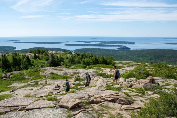
The carriage roads are the best way to see the agricultural remnants without dealing with the Park Loop Road traffic. The Amphitheater Loop starts at the Jordan Pond parking area and climbs past stone bridges and granite walls that farmers built to contain sheep. By June the tourist surge hasn't fully hit, and you can bike the roads early in the morning with only birdsong and the crunch of gravel under your tires. The farms are gone, but the landscape still holds their shape.