8 Best National Parks for Backpacking
Eight national parks where backpacking means something more than a long day hike—from Alaska's trackless tundra to Utah's slickrock canyons
Most national park rankings tally up iconic landmarks or scenic drives, but backpacking demands different metrics: trail networks that reward multi-day routes, backcountry permits you can actually get, and terrain diverse enough to keep you engaged for a week. The parks on this list offer what Instagram hikers and day trippers miss—the solitude and challenge that come from carrying your life on your back.
April opens backcountry permits in the Southwest and marks the tail end of winter in Alaska's interior, but the rankings below span the full backpacking season. Some of these parks see fewer annual visitors than a Saturday afternoon at Yosemite Valley. Others draw millions but hide uncrowded backcountry once you walk past the trailhead crowds.
Gates Of The Arctic National Park & Preserve
No trails, no roads, no cell service / Twice the size of Yellowstone
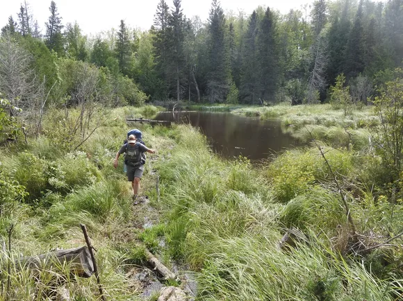
Gates of the Arctic operates on a simple principle: if you want a trail, make your own. The park service doesn't maintain a single marked route through these six million acres of Brooks Range wilderness. You navigate by compass and topographic map, following caribou paths and river corridors through valleys where the only evidence of human presence might be a century-old cache from a hunting party. Most backpackers never see another person during their entire trip.
This is backpacking stripped to its essential truth—you, the terrain, and nothing between them.
The handful of visitors who make it here each year—fewer people than some trailheads see in a morning—fly in from Fairbanks on floatplanes or bush aircraft. July offers the warmest conditions, with highs in the low sixties and enough daylight to hike at midnight. August brings fall colors to the tundra but also the first hard freezes. The Arrigetch Peaks provide alpine scrambling, while the Alatna and Noatak Rivers offer paddling routes that can stretch for weeks.
Isle Royale National Park
Lake Superior island with no roads / Ferry-access wilderness
Isle Royale rewards the effort it takes to reach it. You'll board a ferry from Michigan's Upper Peninsula or Minnesota's North Shore for a crossing that can take up to six hours, depending on your departure point. Once you step off the boat at Rock Harbor or Windigo, you're committed—no roads connect the park's campgrounds, and the next ferry might not arrive for three days. The Greenstone Ridge Trail runs the island's spine for forty miles, while the Minong Ridge offers a more rugged northern alternative.
The island's remoteness creates a peculiar freedom: you can't leave, so you might as well settle into the rhythm of trail miles and camp chores.
The park maintains thirty-six campgrounds scattered across the island's trail network, most tucked into forest clearings near Lake Superior's rocky shoreline. You'll share the island with wolves and moose, though you're far more likely to spot the latter. July brings mild temperatures in the low seventies and reasonable bug pressure. August extends the season with warmer water for paddlers exploring the island's coves and harbors. The park closes entirely from November through mid-April, when ice locks in the island.
Canyonlands National Park
Four separate districts carved by desert rivers / Permits required year-round
The Needles District offers Canyonlands' best backpacking, with routes through slot canyons and past sandstone spires that reward multi-day loops. Chesler Park puts you in the middle of a grassland surrounded by red rock towers, while the Joint Trail squeezes you through a crack in the earth barely wide enough for a loaded pack. The Maze District sees even fewer visitors but demands advanced navigation skills and high-clearance four-wheel-drive just to reach the trailheads.
April hits the sweet spot when daytime temperatures climb into the seventies but haven't yet reached the punishing heat that bakes the canyon floors by June.
The park's permit system limits backcountry numbers to protect both the fragile desert soils and the experience itself. You'll need to specify your exact campsites when you apply, and popular zones in the Needles fill months in advance for spring weekends. Water defines desert backpacking logistics here—you'll either carry every drop you need or plan routes around seasonal springs that may or may not be flowing. The Colorado and Green Rivers offer paddling routes that connect to hiking trails, but you'll need shuttle logistics and serious whitewater skills for Cataract Canyon.
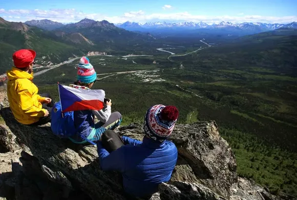
Denali National Park & Preserve
North America's tallest peak anchors six million acres / One road, unlimited tundra
Denali's backcountry works on a unit system: the park divides its wilderness into zones, and rangers issue a limited number of permits for each unit per night. You'll study the map at the Backcountry Information Center, picking units based on terrain, wildlife activity, and current weather. Most backpackers take the park shuttle bus to their starting point along the ninety-two-mile Park Road, then strike out across trackless tundra. The lack of maintained trails means you're free to follow ridgelines and river valleys wherever the landscape leads.
Walking across tundra feels like hiking on a sponge—each step compresses lichens and moss that have been growing for decades.
July offers the most stable weather, with highs in the mid-sixties and long daylight hours that let you hike until midnight if mosquitoes allow. Grizzlies are common throughout the park, and you'll carry a bear canister for all food storage. The mountain itself—twenty thousand feet of rock and ice dominating the Alaska Range—hides behind clouds roughly seventy percent of summer days. When it clears, you'll understand why Denali earns its indigenous name: The Great One.
Glacier National Park
Seven hundred trail miles through alpine wilderness / Permit lottery opens in March
Glacier's trail network connects backcountry chalets and campgrounds through high passes where you'll cross snowfields in July and spot mountain goats on cliff faces. The Gunsight Pass route links Lake McDonald to the Many Glacier area, climbing over the Continental Divide with views that stretch into Canada. The Belly River valley offers a quieter alternative, with trails following rivers through forests of lodgepole pine and subalpine fir before breaking into alpine meadows.
You're hiking through a landscape that's melting: the park's twenty-six remaining glaciers have lost eighty-five percent of their mass since the late 1800s.
The permit system operates on a split reservation model—half the backcountry sites open to advance reservations starting in mid-March, while the other half remain available as walk-up permits. Popular corridors like the Highline Trail and Grinnell Glacier routes fill within hours of the reservation window opening. June offers the best chance at permit availability, plus wildflowers exploding across the meadows as snowmelt recedes. By August, huckleberries ripen along the trails and grizzlies focus on berries instead of hikers.
Grand Canyon National Park
One mile deep, 277 miles long / Rim-to-rim in three days
The classic Grand Canyon backpacking trip drops from the South Rim to Phantom Ranch, then climbs out the North Rim—twenty-four miles with a vertical mile of descent followed by an equally brutal ascent. Most hikers split the route over three days, camping at Bright Angel Campground near the Colorado River and Indian Garden on the return climb. The Hermit Trail offers a less crowded alternative, descending through red rock layers to the Tonto Platform, where you can link together multi-day loops.
The canyon inverts normal mountain logic: you start with the hardest part at the end, when your legs are spent and your water's running low.
April brings comfortable rim temperatures and manageable heat at the river, though water sources along the trails become crucial as you drop through desert zones. The park service rations backcountry permits by zone, and you'll need to specify your exact itinerary four months in advance for spring trips. Summer temperatures at the river bottom regularly exceed a hundred degrees, making May through September brutal for inner canyon travel. October reopens the prime season as temperatures moderate and fall light turns the canyon walls gold and crimson.
Katmai National Park & Preserve
North America's largest brown bear population / Floatplane-access backcountry
Katmai's backcountry sits in the shadow of its famous bear-viewing platforms at Brooks Falls, but backpackers who venture beyond the developed areas find volcanic landscapes and coastal routes where bears outnumber people by orders of magnitude. The Valley of Ten Thousand Smokes spreads ash and pumice across forty square miles, the remnant of the 1912 Novarupta eruption that buried the valley under seven hundred feet of material. You'll hike across moonscape terrain to reach Knife Creek and the backcountry beyond.
Every bear encounter here carries weight—you're the visitor in their salmon pantry, not the other way around.
June offers the best backpacking weather before peak bear activity concentrates along salmon streams in July and August. Most backpackers arrange floatplane drops to reach remote lakes and coastal areas, then hike back toward civilization. The park requires bear-resistant food canisters throughout the backcountry, and rangers emphasize group travel and noise-making in brushy areas. Weather shifts fast off the Pacific, and you'll want four-season tent stakes for winds that can flatten under-equipped camps.
North Cascades National Park
Three hundred glaciers three hours from Seattle / Most people have never heard of it
North Cascades holds more glacial ice than any park in the Lower 48, but fewer than seventeen thousand people visit annually—about what Yosemite sees on a summer weekend. The Cascade Pass Trail serves as the gateway to the park's high country, climbing through old-growth forest to alpine meadows beneath peaks that scrape nine thousand feet. Beyond the pass, trails link to Stehekin, the roadless valley accessible only by boat, floatplane, or foot.
The park's obscurity protects what matters most: you can still hike for days without passing another party.
August offers the most reliable weather, though even summer brings frequent rain in a range that wrings moisture from Pacific storms. Snow lingers on high passes well into July, and some years never fully melts from the cols. The park maintains minimal facilities—ten campgrounds scattered across the wilderness, no entrance station, and rangers who encourage self-reliance. Diablo Lake's turquoise water marks the southern boundary, fed by glacial flour that turns the reservoir an unnatural shade of blue.