8 national parks that become a different place in September
Eight severely underrated parks that transform in September when the crowds vanish and winter hasn't yet locked the gates
Most national parks are defined by their peak season. You visit Yellowstone in summer, Zion in spring, and the Smokies when the leaves turn in October. But the parks on this list follow different rules: they transform in September not because the foliage changes color or the weather turns pleasant, but because most people have never heard of them and September is the last month you can reasonably reach them before winter locks the gates.
These eight parks share two traits that make September distinct: they're severely underrated, drawing a fraction of the attention they deserve, and they're remote enough that logistics become a planning factor. You won't stumble into any of them on a road trip. But if you're willing to book a floatplane, rent a canoe, or drive farther than your phone has signal, September offers a window when the crowds thin, the air sharpens, and the landscapes reveal themselves without the summer crush.
Lake Clark National Park & Preserve
Two active volcanoes, turquoise glacial lakes, bears fishing for salmon / Floatplane access only
Lake Clark sits across Cook Inlet from Anchorage, close enough to see on a clear day but separated by enough water and roadless wilderness that fewer people visit annually than attend a single weekend at Acadia. You arrive by floatplane from Anchorage or Kenai, landing on one of the park's glacial lakes where the water is so turquoise it looks retouched. September brings the tail end of the salmon run, which means brown bears are still fishing the streams, and the tundra has started its shift from green to rust. The crowds, such as they were, have vanished.
Lake Clark is what Alaska looked like before Alaska became a brand.
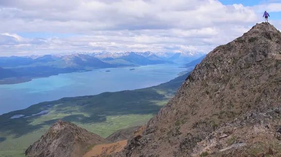
Most visitors base themselves at one of the wilderness lodges along the lakeshore, using it as a staging point for day hikes into the Chigmit Mountains or paddling trips along the coast. The Twin Lakes Trail climbs through boreal forest to alpine tundra with views of Mount Redoubt, an active volcano that last erupted in 2009. If you're willing to carry a tent, the Portage Valley Trail pushes deeper into the backcountry, following a river corridor that cuts between glaciated peaks. The park has no designated campsites, no cell service, and no maintained trails beyond a handful near the lodges. You navigate by topographic map and your own judgment.
Kobuk Valley National Park
Six hundred square miles of sand dunes in the Arctic / Fewer visitors than most state parks
Kobuk Valley is home to the Great Kobuk Sand Dunes, a landscape so improbable you'll spend your first hour trying to reconcile the fact that you're standing on shifting sand surrounded by tundra and boreal forest. The dunes were carved by glacial winds during the last ice age and remain active today, migrating slowly across permafrost. September is the last reasonable month to visit before the Kobuk River begins to freeze and air charters become weather-dependent. The Western Arctic Caribou Herd, one of the largest in North America, begins its fall migration through the park, funneling through Onion Portage, a river crossing that's been used for over ten thousand years.
You don't visit Kobuk Valley casually; you commit to it with the understanding that the logistics are part of the experience.
Access requires a chartered flight from Kotzebue, which itself requires a connecting flight from Anchorage. Most visitors fly in, spend two to four days camping near the dunes or along the river, then fly out. The park has no facilities, no trails, and no rangers on-site. You hike across open tundra and wade through shallow creeks, following game trails when they exist and your own route when they don't. The dunes rise as high as a ten-story building, and climbing them in September means cooler temperatures and fewer mosquitoes than summer, though you'll still want a headnet. At night, the lack of light pollution makes the stars feel close enough to interfere with your depth perception.
Voyageurs National Park
Boats replace roads through a 340-square-mile water maze / Fewer people than a busy weekend at Arches
Voyageurs is a park designed around water. The land exists mostly as a frame for four interconnected lakes, and you reach most of the park by motorboat, canoe, or kayak. There are no roads into the interior. September marks the end of the boating season before the lakes begin their freeze, and the timing brings cooler air, thinner crowds, and fish that are more aggressive as they feed before winter. The park sits on the Canadian Shield, some of the oldest exposed rock on the planet, and the shoreline is a maze of islands, bays, and narrows that you navigate by chart.
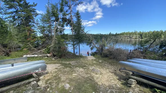
Voyageurs rewards patience: the more time you spend on the water, the more the park's logic reveals itself.
You can rent a houseboat and anchor in a different bay each night, or paddle a canoe to one of the backcountry campsites scattered across the islands. Rainy Lake and Kabetogama Lake are the most accessible, with boat launches near the park's visitor centers. If you're after solitude, push farther into Namakan Lake or Sand Point Lake, where the bays are deeper and the campsites more isolated. Fishing is exceptional: walleye, northern pike, and smallmouth bass, with September being one of the best months for size and activity. The park also offers ranger-led boat tours to Kettle Falls, a historic dam and hotel accessible only by water, where you can dock, stretch your legs, and tour a building that's been operating since the early 1900s.
Glacier Bay National Park & Preserve
Fifteen tidewater glaciers calving into a 65-mile fjord / Humpback whales surface within camera range
Glacier Bay is a park you experience from the deck of a boat. Most visitors arrive on cruise ships, which are allowed limited entry permits each day, but if you want the park without the buffet line, charter a tour boat out of Bartlett Cove or paddle a kayak into the fjords. September brings cooler air and the end of the cruise season, which means fewer ships and quieter water. The glaciers calve year-round, sending house-sized chunks of ice into the bay with a crack that echoes off the surrounding mountains. Humpback whales feed in the nutrient-rich water, and you'll often see them breach or surface within a few hundred yards of your boat.
Glacier Bay is a lesson in geological speed: the ice has retreated 65 miles in the past 250 years, faster than almost anywhere else on Earth.
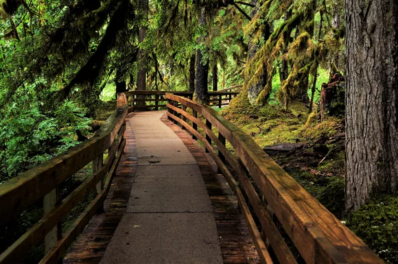
Bartlett Cove serves as the park's base, with a lodge, campground, and visitor center surrounded by temperate rainforest. The Forest Loop Trail offers an easy walk through moss-draped spruce and hemlock, while the longer Bartlett Cove Trail follows the shoreline with views across the bay. If you're paddling, the West Arm offers the most dramatic glacier access, though it requires several days and experience in cold water conditions. Ranger programs run through September, including evening talks on the lodge deck and guided walks through the rainforest. The park's remoteness keeps it off most itineraries, but it's one of the most accessible ways to see active tidewater glaciers without committing to a multi-day expedition.
Kenai Fjords National Park
Exit Glacier is the only glacier in Alaska you can reach by road / Retreat markers show how fast the ice is vanishing
Kenai Fjords is Alaska's most accessible glacier park, which is a relative term: you still need to drive two hours from Anchorage and commit to a boat tour or a strenuous hike to see the best of it. Exit Glacier sits at the park's northern edge, reachable by a paved road that ends at a parking lot where you can walk to the glacier's terminus in under a mile. Markers along the trail show where the ice stood in previous decades, a sobering timeline of retreat that drives home the speed of climate change. September brings fewer tour buses and cooler temperatures, making it one of the better months to hike the Harding Icefield Trail, an eight-mile round trip that climbs from rainforest to alpine tundra to the edge of a 700-square-mile icefield.

The Harding Icefield Trail doesn't ease you into the elevation; it just climbs, relentlessly, until the trees disappear and the ice spreads in every direction.
The park's fjords are accessible only by boat, with tours departing from Seward. September tours are shorter and cheaper than summer, with fewer passengers and better odds of seeing orcas, sea otters, and puffins. The boats push into narrow fjords where glaciers spill into the sea, and you'll spend an hour drifting near the ice walls, waiting for them to calve. Northwestern Glacier and Aialik Glacier are the most visited, but the park has over 40 named glaciers, most of them retreating. If you're kayaking, the fjords near Aialik Bay offer multi-day routes with bear-proof food lockers at designated campsites.
Isle Royale National Park
Remote Lake Superior island with more trail miles than many states / No roads, no cell service, just forest camps
Isle Royale is the most remote national park in the Lower 48, a 45-mile-long island in Lake Superior that you reach by ferry or seaplane. Most visitors are backpackers committed to multi-day trips along the island's 165 miles of trail, sleeping in shelters or tent sites scattered along the ridgelines and coves. September is the tail end of the season before the ferries stop running, and the island takes on a quieter, sharper quality: the bugs are gone, the water is still warm enough to swim, and the fall colors start creeping into the maples and birches.
Isle Royale is a park that rewards slow travel; the island doesn't reveal itself in a weekend, and it's not designed to.
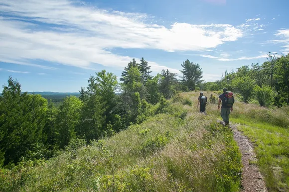
The Greenstone Ridge Trail runs the length of the island along its spine, offering views of both the north and south shores from ridgetop camps. The Minong Ridge Trail is more remote and more challenging, with steep climbs and fewer shelters, attracting backpackers who want solitude even by Isle Royale standards. If you're less interested in long mileage, base yourself at Rock Harbor and take day hikes to Suzy's Cave, Mount Franklin, or Scoville Point. Moose and wolves are the island's most famous residents, though you're far more likely to see evidence of them than the animals themselves. The island's shipwrecks are accessible to divers and kayakers, and the park offers ranger-led programs on the island's ecology and the decades-long wolf-moose study that's one of the longest predator-prey studies in the world.
Denali National Park & Preserve
North America's tallest peak anchors six million acres / One road separates you from wilderness
Denali is the rare park where the access is part of the strategy. Only one road cuts into the interior, and private vehicles are restricted beyond mile 15. You ride a park bus deeper into the backcountry, scanning the tundra for grizzlies, caribou, and Dall sheep while the Alaska Range rises to the south. September is the last month the road is open to its full length, and it's one of the best times to see Denali itself: the mountain is visible only 30 percent of the time, but September has statistically better weather than summer. The fall colors peak mid-month, turning the tundra into a patchwork of red, orange, and gold.
Denali doesn't feel like a park with six million acres; it feels like six million acres where a park was quietly added without disturbing anything.
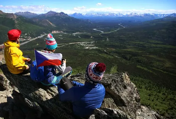
The park's trails are short and frontloaded near the entrance: Mount Healy Overlook climbs steeply to a ridgeline with views across the Nenana River valley, while the Savage River Loop offers an easier walk through willow and spruce. The real hiking happens off-trail. The park issues backcountry permits for zones deep in the interior, and you navigate by topo map and compass across open tundra where there are no trails and no other hikers. Grizzlies are common, and you'll need to carry bear-proof canisters and know how to move through their territory without spooking them. The bus system drops you at designated stops, and you hike from there, returning to the road when your permit expires.
Gates of the Arctic National Park & Preserve
Six million acres where caribou migrations follow ancient routes / No trails, no campgrounds, no infrastructure
Gates of the Arctic is the most remote park in the system, a wilderness so vast and undeveloped that calling it a park feels misleading. There are no trails, no campsites, no visitor centers, and no roads. You fly in by bush plane, land on a gravel bar or alpine lake, and hike from there. September is one of the few months when access is feasible: the rivers are low enough to ford, the tundra is firm underfoot, and the fall colors light up the valleys in shades that look Photoshopped. The park sits entirely above the Arctic Circle, and the Brooks Range dominates the landscape with peaks that rise abruptly from tundra and glacial valleys.
Gates of the Arctic is a park that doesn't compromise; it asks you to meet it on its terms or not at all.
Most trips are week-long expeditions, either hiking ridge-to-ridge across the tundra or paddling one of the park's wild rivers. The Alatna River and the North Fork of the Koyukuk are the most commonly paddled, though calling them common is a stretch when the entire park sees fewer visitors annually than Yosemite gets in a single day. Dall sheep inhabit the high country, and caribou herds pass through the valleys during their migration. You navigate without trails, following drainages and ridgelines, camping wherever the terrain allows. The logistics are complex enough that most visitors hire guides or join group trips, though experienced backcountry travelers with strong navigation skills can plan their own routes. September's shorter days and colder nights add urgency: winter arrives fast above the Arctic Circle, and you don't want to still be in the backcountry when the weather turns.