8 national parks where July crowds stay manageable
Eight national parks where July crowds stay thin, from North Dakota badlands to remote Alaska dunes
July is peak season at most national parks, when parking lots fill by sunrise and trailheads turn into waiting rooms. But the system includes 63 parks, and eight of them absorb summer crowds so effectively that you'll still find room to breathe. These aren't obscure sites with nothing to see. They're parks where the terrain spreads visitors thin, where access requires effort, or where most Americans simply haven't heard the name yet.
The rankings here measure visitor distribution against available space and trail miles. A park earns its spot by offering genuine solitude in July, not just marginally fewer people than Yellowstone.
Theodore Roosevelt National Park
North Dakota badlands where bison outnumber tourists most mornings / Peak season is July
The Painted Canyon overlook pulls over every tourist driving Interstate 94, which means the South Unit's Scenic Loop Drive gets busy by midday in July. But Theodore Roosevelt's backcountry trails see almost nobody. The Petrified Forest Loop delivers nearly 12 miles of eroded buttes and wild bison without the crowds that pack the main scenic drive. Most visitors never leave their cars, which creates a strange dynamic: you can watch a dozen people photograph the same bison from a pullout, then hike two miles and not see another human for hours.
The badlands look desolate until you're in them, when the coulees reveal pockets of green and the silence becomes the point.
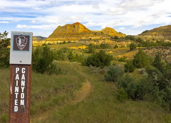
The North Unit sits 70 miles from the main entrance and draws a fraction of the South Unit's traffic. Buckhorn Trail climbs through juniper breaks to ridge tops where you can see into Montana. July temperatures push into the mid-80s by afternoon, but mornings stay cool enough for comfortable hiking. The park's real advantage is scale: it's small enough to cover the highlights in a long weekend but sprawling enough that its relatively high visitor count doesn't translate to crowded trails.
Voyageurs National Park
Four interconnected lakes where boats replace roads / Fewer visitors than a mid-tier state park
Voyageurs draws so few people that it ranks in the bottom fifth of all national parks for annual visitation. Even in August, its peak month, the park feels empty. July is slightly quieter. The catch is access: you need a boat to see most of the park. Rainy Lake and Kabetogama Lake dominate the landscape, with scattered islands holding most of the campsites and trails. If you're willing to paddle or rent a motorboat, you'll have 340 square miles of boreal wilderness almost to yourself.
Voyageurs trades the iconic peak-and-valley drama of western parks for something harder to photograph: space, silence, and water that goes on longer than you'd think possible in Minnesota.
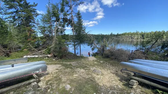
The Kabetogama Lake Shore Trail offers one of the few ways to explore on foot without a boat, winding four miles along the shoreline through mixed forest. Most visitors stick to the Rainy Lake Visitor Center and its short nature trail, which sees moderate traffic but nothing close to crowded. July highs reach the mid-70s, perfect for paddling and swimming. The park's boat-in campsites rarely fill, even on holiday weekends. If you've never considered a water-based camping trip, this is the national park where the learning curve pays off.
Lassen Volcanic National Park
Boiling mudpots and alpine lakes three hours from Sacramento / The crowds skip it for Yosemite
Lassen sits in the volcanic gap between the Cascades and the Sierra, close enough to major California cities that it should be packed. Instead, it absorbs July visitors across 80 trails and 130 miles of backcountry without feeling crowded. The Lassen Peak Trail, a five-mile roundtrip climb to the summit of an active volcano, sees the most traffic. Even there, you'll find stretches of solitude once you're above the first switchbacks. Bumpass Hell, the park's largest hydrothermal area, draws steady crowds to its boardwalks, but the parking lot fills and empties in waves rather than staying jammed all day.
The sulfur smell hits you before you see the mudpots, a reminder that Lassen's last eruption was 1917, not 1817.
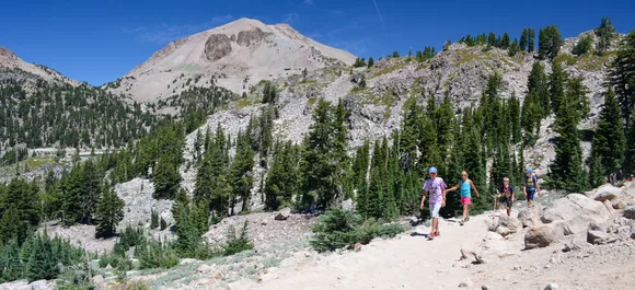
July is the park's busiest month, but it's also when the high country finally sheds its snowpack and the full trail network opens. Cinder Cone Trail delivers a moderate four-mile loop through a textbook volcanic landscape: black sand, rust-colored slopes, and views across the Fantastic Lava Beds. Manzanita Lake Loop offers an easy alternative for families, circling a clear alpine lake with the peak reflected in the water on calm mornings. Temps stay mild, with highs in the low 60s at elevation. Most campgrounds have availability through midweek, and the backcountry permits never sell out.
Wind Cave National Park
One of the world's longest caves beneath mixed-grass prairie / Bison herd above, boxwork formations below
Wind Cave splits its identity between underground and above. Most visitors spend an hour on a cave tour, marvel at the boxwork calcite formations found almost nowhere else on Earth, then leave. The prairie above holds one of the country's healthiest bison herds, plus elk, pronghorn, and black-footed ferrets. The 40 miles of surface trails see light traffic even in July, when the cave tours book solid. Elk Mountain Trail and Rankin Ridge Trail both offer ridge-top views across the Black Hills, with wildlife sightings almost guaranteed.
The cave breathes, inhaling and exhaling through its entrance with enough force to knock off a hat when the barometric pressure shifts.
July brings warm days in the mid-80s, but the cave stays a constant 54 degrees year-round. The contrast makes the Natural Entrance Tour feel like stepping into a refrigerator. Above ground, the mixed-grass prairie turns gold by midsummer, and the bison move between the draws to find shade and water. Wind Cave Canyon Trail follows a wooded canyon through ponderosa pines, offering a cooler alternative to the open grassland hikes. The park sits 30 minutes from Custer State Park and an hour from Mount Rushmore, yet it absorbs only a fraction of the Black Hills tourist traffic.
Great Basin National Park
Wheeler Peak towers over Nevada's emptiest park / Ancient bristlecones and marble caves hours from the nearest traffic jam
Great Basin draws fewer visitors than most state parks, despite protecting some of the oldest living trees on Earth and one of the country's most decorated cave systems. The five-hour drive from Las Vegas keeps crowds thin. July sees the park's second-highest visitation after September, but the numbers are so low that you'll still find empty trailheads at midday. Wheeler Peak Trail climbs 3,000 feet over nine miles to the summit, passing alpine lakes and bristlecone groves. The Bristlecone Pine Trail offers an easier option, a three-mile loop through trees that have survived 4,000 winters.
The bristlecones grow so slowly that a trunk the width of your thigh might be older than the pyramids.
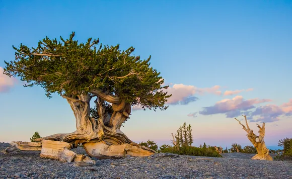
Lehman Caves draws the most visitors, but even the popular Lodge Room Tour rarely feels crowded. The cave's shield formations and helictites rival anything at Carlsbad, yet you can often book same-day tour tickets in July. Above ground, the Wheeler Peak Scenic Drive climbs from desert scrub to alpine forest in 12 miles, with pull-offs that look west across Nevada's basin-and-range country. Summer highs reach the upper 70s in the valleys, but the high country stays cool. Most campgrounds operate first-come, first-served, and they rarely fill except on holiday weekends.
North Cascades National Park
Three hundred glaciers three hours north of Seattle / The most glaciated terrain in the Lower 48
North Cascades draws fewer annual visitors than Acadia sees in a single summer week. The park protects nearly 800 square miles of alpine wilderness, but State Route 20 provides the only road access, and it closes under snow from November through April. July sees moderate traffic on the accessible trails near the highway, but venture beyond Cascade Pass or Diablo Lake and you'll have the mountains to yourself. The park's jagged peaks and ice fields look more like Alaska than Washington, and the trail network reflects that scale: long approaches, steep climbs, and backcountry campsites that require advance planning.
The glaciers are shrinking, but they're still carving the landscape in real time, grinding rock into flour that turns the alpine lakes an otherworldly turquoise.
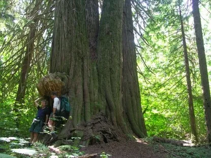
Cascade Pass Trail remains the park's most-hiked route, a moderate 7.5-mile roundtrip that climbs through old-growth forest to an alpine basin with views of Johannesburg Mountain and Mixup Peak. The trailhead parking lot fills by midmorning on summer weekends, but the crowds thin within the first mile. Diablo Lake Trail follows the shoreline through forest, with views across water that looks photoshopped until you see it in person. Rainy Lake offers the easiest option, a paved two-mile loop that's accessible to wheelchairs and strollers. July highs reach the low 70s at lake level, but the high country stays cold enough for snow patches into August.
Kobuk Valley National Park
600 square miles of sand dunes in the Arctic / No roads, no trails, no cell service
Kobuk Valley ranks among the least-visited parks in the system, drawing fewer people in a year than Zion sees in a busy afternoon. The park protects the Great Kobuk Sand Dunes, a surreal expanse of sand rising from tundra 30 miles north of the Arctic Circle. Access requires a flight from Kotzebue to the Kobuk River, followed by a paddle or motorboat ride to the dunes. July is the only practical month to visit, when the river runs high enough for boats and the tundra thaws enough for hiking. Temps reach the mid-60s, and the sun stays above the horizon until nearly midnight.
The dunes look like they've been dropped from another planet, a ribbon of Sahara sand carved by ice-age winds that still push them east across permafrost.
The six-mile hike across the dunes to the Kobuk River passes through ecological layers that shouldn't exist in the same landscape: boreal forest, active sand dunes, and Arctic tundra. The caribou migration passes through Onion Portage in late August and September, but July offers the most stable weather for river travel. The park has no maintained trails, no campgrounds, and no services. You bring everything and take everything out. The effort required to reach Kobuk Valley guarantees solitude, even by national park standards.
Isle Royale National Park
Remote Lake Superior island where wolves, moose, and backpackers share 165 miles of trail / No roads, no cell service, just forest camps
Isle Royale requires a ferry ride or seaplane flight, which filters out the casual visitors. The park sits 50 miles offshore in Lake Superior, a forested island roughly the size of Acadia but with a fraction of the traffic. July is peak season, but the park's multi-day backpacking focus keeps crowds manageable. Most visitors spend three to five days hiking the Greenstone Ridge Trail or paddling the inland lakes and rocky shoreline. Rock Harbor sees the most activity, where the ferry docks and the lodge provides the only accommodations beyond backcountry campsites.
The wolves are the famous residents, but the moose are what you'll actually see, browsing the forest understory like they own the place.
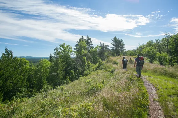
Tobin Harbor Trail offers an easier option for day hikers, winding three miles through mixed forest along the shoreline. The Minong Ridge Trail delivers the park's most challenging route, 28 miles of exposed ridge hiking with views across the island and lake. July highs reach the low 70s, perfect for hiking without the bugs that plague June. The inland lakes warm enough for swimming by midsummer, and the backcountry campsites rarely fill even on holiday weekends. The ferry schedule limits daily arrivals, which caps total visitor numbers in a way no reservation system could match.