8 parks where the drive in is half the adventure
Eight parks where the road in delivers drama before you leave the car, from glaciers to canyons to volcanic craters
Most national parks make you work for the payoff: hike five miles, scramble over talus, earn the vista. But some parks deliver drama the moment you turn off the highway. The approach itself becomes part of the experience, with roads that wind through the terrain they're designed to reveal. These eight parks reward you for showing up, then compound the return when you step out of the car.
August brings long daylight and open roads, the season when mountain passes stay clear and coastal routes stay green. Here's where the drive in sets the tone.
Kenai Fjords National Park
The only road-accessible glacier in Alaska / Exit Glacier retreating faster than you can visit
The Seward Highway hugs Turnagain Arm for 127 miles, winding between cliffs and tide flats where beluga whales surface in summer. By the time you reach Seward, you've already seen enough alpine drama to fill a week, but the park itself waits nine miles up a valley where Exit Glacier spills from the Harding Icefield. Markers along the trail show where the glacier's terminus stood in years past: 1926 is a quarter-mile back, 2010 just a few hundred feet. The ice is vanishing fast enough that the park updates the signs annually.
Exit Glacier is the only place in Alaska where you can drive to the ice and watch it disappear in real time.

Most visitors stop at the toe of the glacier, snap photos, and leave. The Harding Icefield Trail climbs eight miles and 3,000 feet to an overlook where you stand above the ice field itself, a frozen plateau that birthed 40 glaciers and still covers 700 square miles. It's a day hike that delivers alpine tundra, marmots, and views that stretch to the Gulf of Alaska. August brings wildflowers and bearable temps in the low 60s, though the trail stays snow-patched through mid-summer.
Denali National Park & Preserve
One road, 92 miles, North America's tallest peak / Lottery buses replace private cars after mile 15
The Park Road is the entire point here. Private vehicles stop at Savage River, 15 miles in, and from there you board lottery buses that crawl deeper into tundra where grizzlies, caribou, and Dall sheep outnumber people by orders of magnitude. The road was built in the 1930s as a mining route, narrow and unpaved, clinging to ridgelines with no guardrails and drops that make passengers grip their armrests. It takes six hours to reach Wonder Lake, and you'll stop a dozen times for wildlife crossings and photo ops. Denali itself, when visible, dominates the horizon 70 miles away.
The Park Road turns the bus into a mobile observation deck where every passenger becomes a spotter.
Most people assume Denali means summit views and alpine hikes, but the park's real draw is scale and emptiness. The terrain absorbs visitors so completely that even in August, the peak month, you can hike off-trail from any bus stop and disappear into tundra where no one has walked this season. The mountain hides behind clouds two-thirds of the time, but when it clears, the sight stops conversations mid-sentence. At over 20,000 feet, Denali rises higher above its base than Everest does.
Grand Teton National Park
Granite spires visible from the highway / Jenny Lake fills parking lots by 8 AM
The Tetons don't ease into view; they punch through the horizon. Driving north from Jackson on Highway 89, you round a bend at Gros Ventre Junction and the entire range unfolds in one frame: 40 miles of peaks with no foothills to soften the drama. Grand Teton itself, the highest at 13,775 feet, rises nearly 7,000 feet above Jackson Hole in a single vertical thrust. The road runs parallel to the range for 30 miles, and every pullout delivers a postcard you've already seen a hundred times but never quite like this.
The Tetons are the rare mountains that look better from the road than from the summit.
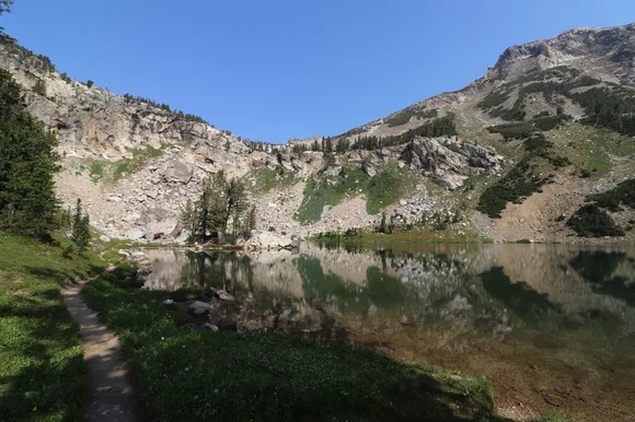
Jenny Lake gets the crowds, but the real reward sits eight miles deeper at String Lake, where a three-mile loop circles water so clear you can count rocks at 20 feet. The trail stays flat and shaded, perfect for families, and connects to Leigh Lake if you want solitude. August temps hit the low 80s in the valley, but the lakes stay cold enough to numb your feet in seconds. Cascade Canyon Trail, accessible by boat shuttle or a two-mile walk from the parking lot, climbs into glacial cirques where marmots whistle from boulder fields and the peaks close in on three sides.
Black Canyon of the Gunnison National Park
2,000-foot walls in a half-mile-wide canyon / South Rim Drive delivers 12 overlooks in seven miles
The canyon doesn't reveal itself until you're standing at the rim, staring down at vertical schist walls that predate most life on Earth. The Gunnison River, barely visible 2,000 feet below, carved this slot through 1.7-billion-year-old Precambrian rock, creating the steepest sustained gorge in North America. South Rim Drive parallels the canyon for seven miles, with pullouts every half-mile that reframe the view: Chasm View drops straight down, Painted Wall shows off the tallest cliff in Colorado, and Sunset View catches alpenglow on the north wall in late afternoon.
Black Canyon earns its name from walls so steep and narrow that sunlight only reaches the river for 33 minutes a day.
Most visitors drive the rim, peer over the edge, and leave within two hours. The canyon's real character emerges on the Rim Rock Trail, a three-mile path that weaves between juniper and overlooks where you can watch ravens ride thermals below your feet. Warner Point, at the road's end, sits 8,400 feet high with views that stretch to the San Juans 100 miles south. August brings afternoon thunderstorms that light up the canyon walls and clear by evening, leaving temps in the low 80s and air that smells like wet sage.
North Cascades National Park
Highway 20 bisects 300 glaciers / Diablo Lake glows turquoise from glacial flour
The North Cascades Scenic Highway climbs from sea-level rainforest to alpine passes in 60 miles, threading through a landscape so jagged and green it feels more like New Zealand than Washington. Diablo Lake appears halfway through, a reservoir stained turquoise by glacial silt so fine it stays suspended in the water. Pull into the overlook at milepost 131 and you'll see why this park gets fewer visitors than any other in the Lower 48: the peaks are too sharp, too numerous, too vertical to process from a car window. The road itself is the compromise, the only corridor through terrain that resists human travel.
North Cascades holds more glaciers than the rest of the Lower 48 combined, and most people have never heard of it.
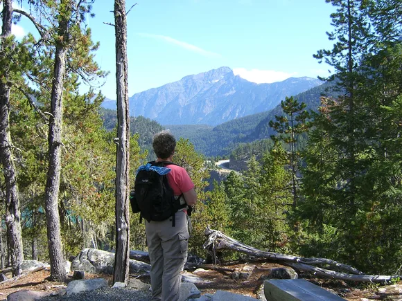
Rainy Lake Trail, a paved two-mile loop near Washington Pass, leads to a waterfall that spills from a hanging glacier. It's wheelchair-accessible and ends at a boardwalk where kids can touch glacial runoff and watch pikas dart between talus. Cascade Pass Trail, starting from the end of a 23-mile dirt road, climbs four miles to a saddle where views open to Johannesburg Mountain and the Ptarmigan Traverse. August is the only reliable month for hiking here; snow lingers on high passes through July and returns in September.
Sequoia & Kings Canyon National Parks
Generals Highway climbs 5,000 feet in 50 miles / Kings Canyon Scenic Byway drops a mile into America's deepest canyon
Two roads define these conjoined parks, and both deliver drama that builds with every switchback. The Generals Highway connects Sequoia and Kings Canyon through Giant Forest, where sequoias line the pavement and trunks exceed 30 feet in diameter. General Sherman, the largest tree on Earth by volume, sits a quarter-mile from a parking lot that fills by 10 AM. The tree is so massive that its first branch, 130 feet up, is wider than most Eastern hardwoods. Keep driving north and the road narrows, twisting through mixed conifer forest where traffic thins and overlooks open to the Great Western Divide.
Kings Canyon Scenic Byway drops from Grant Grove to the canyon floor in 30 miles, losing elevation faster than any paved road in the Sierra.
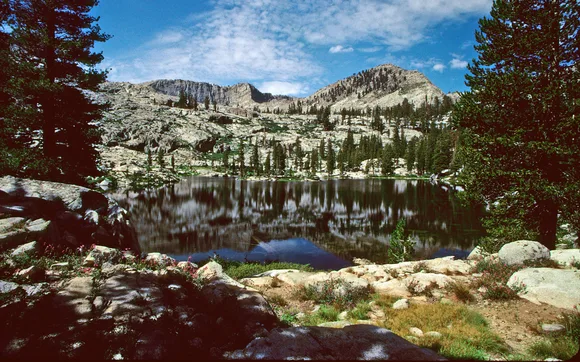
The byway ends at Roads End, where the South Fork Kings River has carved a canyon deeper than the Grand Canyon measured rim to river. Mist Falls Trail, an easy five miles round-trip, follows the river through granite corridors to a 50-foot cascade that soaks the trail in August when snowmelt peaks. The canyon walls rise 8,000 feet on either side, steep enough that shadows swallow the valley floor by mid-afternoon. Traffic is light; most visitors stick to the sequoia groves and never make the drive.
Haleakalā National Park
Sea level to 10,000 feet in 38 miles / Summit sunrise requires reservations booked 60 days out
The drive to Haleakalā Crater is less a road than a controlled ascent through climate zones that shift faster than your ears can pop. You start in Kahului at sea level, wind through sugarcane fields and ranchland, then climb into cloud forest where eucalyptus gives way to alpine shrubland. By the time you reach the summit visitor center at 10,023 feet, you've gained more elevation than any paved road in Hawaii, and the air is thin enough to make you breathless. The crater itself, seven miles wide and 2,600 feet deep, opens like a lunar landscape of cinder cones and lava fields that shift from red to yellow to black depending on the light.
Haleakalā means "house of the sun," and watching dawn from the summit feels like standing at the edge of creation.
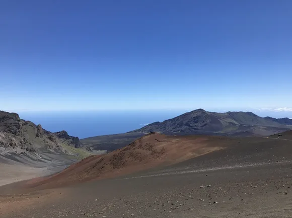
Most visitors come for sunrise, a spectacle that requires reservations and a 3 AM wake-up call, then leave by 9. The real reward comes later, when the crowds thin and you can hike the Sliding Sands Trail into the crater itself. The path drops 2,000 feet in four miles, descending through volcanic ash so fine it feels like hiking on Mars. Silversword plants, found nowhere else on Earth, grow in scattered clusters along the trail, blooming once in 50 years before dying. August brings the warmest temps at the summit, topping out near 60F, but wind chill can drop it to freezing by late afternoon.
Capitol Reef National Park
Highway 24 cuts through the Waterpocket Fold / Pioneer orchards still produce fruit in Fruita
Capitol Reef is the park you drive through by accident and realize you've been missing the point of southern Utah. Highway 24 slices through the Waterpocket Fold, a 100-mile wrinkle in the Earth's crust where sedimentary layers tilt 70 degrees and erode into cliffs, domes, and slot canyons. Capitol Dome, the park's namesake, rises white and round above the Fremont River, visible for miles before you reach the visitor center. The road stays flat and follows the river through cottonwood groves where Mormon pioneers planted orchards in the 1880s. In August, peaches and apples hang heavy on trees you're allowed to pick from for free.
Capitol Reef is the rare desert park where you can eat fresh fruit under shade trees while staring at 200-million-year-old sandstone.
Scenic Drive, a paved spur that heads south from Fruita, dead-ends after eight miles at Capitol Gorge, where a half-mile walk through a slot canyon leads to pioneer inscriptions carved into the walls in the 1880s. Grand Wash, accessible from Highway 24, offers a longer slot hike where the walls close in 500 feet overhead and the temperature drops 20 degrees. Both trails stay flat and easy, perfect for families, and both empty out by late afternoon when the heat drives people back to their cars. The park stays open year-round, but August brings temps near 90F and afternoon thunderstorms that flood the washes within minutes.