8 wheelchair-accessible scenic drives in national parks
Eight national parks where the best views come from the road, not the trail. No vertical gain required
Most national parks promise accessibility in theory. In practice, accessibility means a paved path to a single overlook while the real scenery hides three miles and 800 vertical feet away. But some parks built their signature experiences right into the roadway: drives that deliver the granite cliffs, hoodoo forests, and alpine passes without asking you to leave your vehicle. You won't get the backcountry solitude, but you will get the views that end up on postcards.
These eight parks put their best features within reach of anyone who can sit in a car. June is prime time for most of them, when snowplows have cleared the high passes and summer crowds haven't yet arrived in force.
Acadia National Park
Draws more people than Miami / Park Loop Road delivers ocean cliffs without the scramble
Park Loop Road handles Acadia's crowds by design. The 27-mile circuit runs past Thunder Hole, where waves explode through a natural chasm at high tide, Sand Beach, where the Atlantic stays cold enough to make you gasp in August, and Jordan Pond, where the Bubbles rise like granite loaves across mirror-flat water. Pullouts appear every half mile, and most have level pavement leading to stone walls at cliff's edge. You can watch the sunrise from Cadillac Mountain without hiking the ridge trail, though you'll share the summit parking lot with a few hundred other early risers.
Thunder Hole proves you don't need vertical gain to feel small next to the ocean.
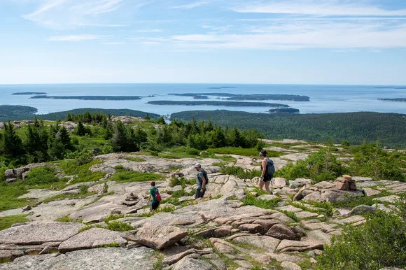
The carriage roads add another 45 miles of car-free, packed gravel paths wide enough for wheelchairs and hand cycles. John D. Rockefeller Jr. built them in the 1920s with grades that never exceed five percent, and they're still the smoothest way to reach the interior forests without dealing with root-choked trails. The Jordan Pond loop runs flat for three miles around the water, passing through birch groves and over stone bridges that belong in a European estate.
Bryce Canyon National Park
Packed shoulder to shoulder in peak season / Rim Trail delivers the hoodoos without the descent
The Navajo Loop drops 500 feet into the hoodoo forest and gets all the attention, but the Rim Trail gives you the same orange spires from above. The paved section runs from Sunrise Point to Sunset Point, a mostly flat mile that puts you at eye level with the tops of the tallest formations. You're looking down into the amphitheater instead of craning your neck from Wall Street's narrow slot, and the perspective makes the scale more obvious: this isn't a collection of rock towers, it's an eroded plateau that goes on for miles.
From the rim, Bryce looks like a city built by a civilization that worshipped geometry and left before finishing.
The 18-mile scenic drive hits all four overlooks, each one framing a different section of the amphitheater. Inspiration Point lives up to its name despite the crowds, and Bryce Point adds the Agua Canyon hoodoos in the distance. At 8,000 feet, the air is thin enough to make you breathe hard just walking from the parking lot, but the views don't ask for more effort than that. Summer afternoons bring thunderstorms that turn the red rock purple-black under storm light.
Grand Canyon National Park
More visitors than Los Angeles has people / Desert View Drive stretches 25 miles along the rim
The South Rim's village area gets packed because it delivers exactly what people came for: a mile-deep chasm that defies the brain's ability to process scale. But Desert View Drive, the eastern stretch of rim road, spreads those crowds across a dozen overlooks. Each one frames a different cross-section of the canyon, and most have level pathways leading to the edge. Moran Point shows the Colorado River from directly above, a thin green line at the bottom of rust-colored walls. Lipan Point adds the eastern canyon in profile, where the strata tilt like a geologic textbook diagram.
The Grand Canyon doesn't reveal itself all at once; it makes you work through the disbelief one viewpoint at a time.
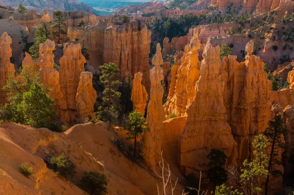
Desert View Watchtower, at the eastern end of the drive, gives you elevation and architecture: a 70-foot stone tower designed to look like an ancestral Puebloan structure, with windows framing the Painted Desert to the east. The park's size absorbs the crowds better than most, and you can usually find an empty stretch of rim if you're willing to walk 200 yards from the parking lot. October brings cool air and golden light that turns the red rock bronze at sunset.
Glacier National Park
Twenty-six glaciers left from 150 / Going-to-the-Sun Road crosses the Continental Divide at Logan Pass
Going-to-the-Sun Road is the reason most people visit Glacier, and it's the rare scenic drive that actually deserves the hype. The 50-mile route climbs from Lake McDonald's cedar forests through a dozen climate zones to Logan Pass at 6,646 feet, where alpine meadows bloom with glacier lilies in July and bighorn sheep wander the parking lot looking for handouts. The road clings to cliff faces so narrow that RVs and trailers are banned, and the pullouts come with sheer drops that make you check your parking brake twice.
Logan Pass sits at the spine of the continent; water falling on one side flows to the Pacific, the other to the Gulf of Mexico.
The Hidden Lake Overlook trail starts at the visitor center and climbs a mile and a half on a boardwalk to a viewpoint above an alpine lake that stays frozen into July. The trail gains 460 feet, but the boardwalk makes it manageable for anyone who can handle the altitude. The Many Glacier area, on the park's east side, offers another option: a drive to Swiftcurrent Lake with mountain goats on the slopes above and grizzly bears in the willows below. Glacier is one of the few parks where wildlife viewing from your car is better than hiking, simply because the animals don't care about the road.
Rocky Mountain National Park
Trail Ridge Road tops out at 12,183 feet / Tundra ecosystems usually require a week of backpacking
Trail Ridge Road is the highest continuous paved road in the country, and it puts you in alpine tundra without asking for crampons or a tent. The 48-mile route crosses the Continental Divide at 12,000 feet, where the trees give up entirely and the landscape looks more like Alaska than Colorado. Pullouts appear every few miles, most with short paved paths leading to overlooks where you can see a hundred miles of peaks on clear days. The air at this elevation makes you dizzy if you move too fast, and thunderstorms build without warning after noon.
Trail Ridge Road proves that altitude, not distance, is what keeps most people out of the high country.
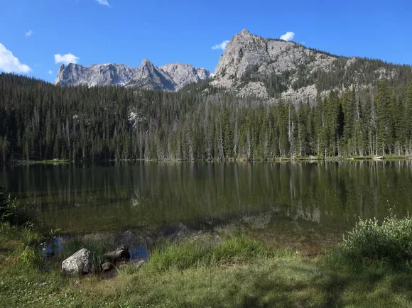
Bear Lake Road, on the park's east side, delivers a different kind of access: glacial lakes surrounded by subalpine forest, all reachable on paved or boardwalk trails. Bear Lake itself sits at 9,450 feet with Hallett Peak reflected in water so still it looks like glass. The half-mile loop around the shore is paved and mostly flat, and it connects to longer trails if you want to push toward Emerald Lake or Dream Lake. Elk roam the meadows at dawn and dusk, close enough to the road that you'll see them from your car more often than not.
Shenandoah National Park
105 miles of ridgeline / Skyline Drive never drops below 2,000 feet
Skyline Drive traces the Blue Ridge crest for its entire length, and the overlooks appear so frequently that you could stop at every one and still finish the drive in a day. Most pullouts have paved paths leading to stone walls at the edge, where the Shenandoah Valley spreads out to the west and the Piedmont rolls east toward Washington, D.C. The elevation gain comes from the road itself, not the trails, and the views are better from the car than from most of the summits. October turns the hardwood forests into a patchwork of red and gold that brings traffic to a crawl on weekends.
Skyline Drive was built during the Depression by workers who carved a road through mountains that had been farmland a generation earlier.
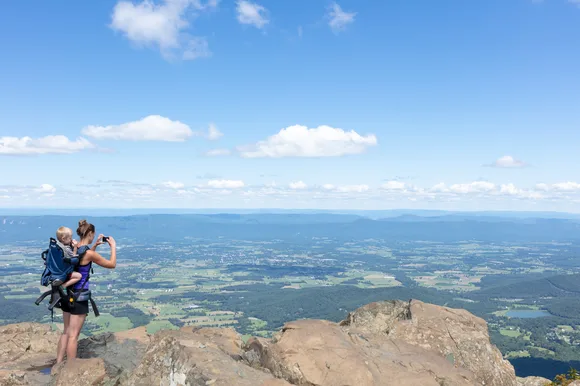
Dark Hollow Falls, one of the park's most popular short hikes, drops 70 feet through a hemlock gorge just over a mile from the road. The trail loses 440 feet on the way down, which means you'll earn it back on the return, but the path is paved and the waterfall is worth the knee strain. Limberlost Trail offers a flatter option: a mile-long loop through old-growth hemlocks on a crushed greenstone surface designed for wheelchairs. The forest here survived the logging era by accident, and the trees are thick enough to block the sky.
Badlands National Park
65 million years of sediment / 30-mile loop road puts you inside the formations
The Badlands Loop Road runs through the formations instead of above them, so you're driving at the base of 300-foot walls that look like they belong on another planet. The white and tan spires weather so fast you can see new shapes forming between visits, and the pullouts let you walk right up to the crumbling cliffs. Door Trail and Window Trail both use boardwalks to reach overlooks where the formations stretch to the horizon, and Fossil Exhibit Trail puts you on a quarter-mile loop through a fossil bed with replicas of ancient mammals that roamed here 30 million years ago.
The Badlands look like erosion hit fast-forward: every rainstorm reshapes the spires, and every winter freeze cracks new fissures into the clay.
The park is small enough to drive in an afternoon, but the formations change character with the light. Morning sun hits the eastern faces and makes the white layers glow, while sunset turns the whole park pink and purple under alpenglow. Bighorn sheep wander the ridges above the road, and bison graze in the mixed-grass prairie that borders the formations. The park sits an hour east of Rapid City, close enough to visit on a half-day detour but empty enough that you'll have pullouts to yourself outside of July.
Arches National Park
Over 2,000 natural arches / Scenic drive reaches seven major formations without hiking
Arches packs more geology per square mile than almost any park in the system, and the scenic drive delivers a dozen iconic formations within 20 miles of pavement. Balanced Rock sits 50 feet from the parking lot, a 128-foot spire topped with a boulder the size of a house. The Windows Section puts you at the base of North and South Window Arches, both reachable on a paved trail that gains minimal elevation. Double Arch rises 160 feet at the end of a half-mile walk through sand, and the scale doesn't register until you're standing underneath the twin spans.
Arches makes you rethink what rock can do: span, balance, frame, and somehow stay standing despite all evidence it shouldn't.
Delicate Arch, the park's most famous feature, requires a three-mile round trip hike with 480 feet of elevation gain, but the Lower Delicate Arch Viewpoint offers a distant look from a paved path. You won't get the full effect, but you'll get the shape and the setting: a freestanding arch on the edge of a sandstone bowl with the La Sal Mountains behind it. The park gets packed in spring and fall when temperatures are manageable, and the parking lots fill by mid-morning. June is hot but less crowded, and the red rock looks better under harsh light anyway.