Alum Cave Trail vs Bearfence Mountain Loop: which trail should you hike?
Mount Le Conte is the third-highest peak in the Smokies, and you can reach it on five different trails. The Appalachian Trail and Boulevard route is the long...
Mount Le Conte is the third-highest peak in the Smokies, and you can reach it on five different trails. The Appalachian Trail and Boulevard route is the longest of them all, stretching over sixteen miles roundtrip and winding through some of the park's most iconic high-elevation terrain. The Bullhead Trail is the underdog: nearly fourteen miles, equally punishing on the knees, but far quieter. Both routes deliver you to the same summit, but the journey couldn't be more different.
The Appalachian Trail option starts high at Newfound Gap, skips the lower-elevation slog, and keeps you on ridgelines where the views open up early. Bullhead launches from Cherokee Orchard, which means you earn every foot of altitude through dense forest before breaking into the alpine zone. If you're choosing between them, you're choosing between scenic mileage and solitary suffering.
Neither trail is for casual hikers. Both demand a full day, solid conditioning, and a willingness to keep moving when your quads start screaming. But they reward different priorities, and the right choice depends on whether you value panoramas or peace.
The Starting Line
The Appalachian Trail route begins at Newfound Gap, one of the most accessible trailheads in the park. You're already over 5,000 feet up when you lace your boots, which means you skip the humid hardwood forests that dominate lower-elevation hikes in the Smokies. The parking lot fills fast in summer and fall, but it's massive compared to most trailheads here. You'll share the first few miles with AT thru-hikers, day-trippers heading to Charlies Bunion, and anyone chasing that ridge-walking high.
Bullhead starts at Cherokee Orchard, a smaller lot tucked into the foothills near Gatlinburg. The trailhead sits at around 3,600 feet, which means you face a steeper cumulative climb and start in the thick of Appalachian forest. The lot here is modest, and on weekends it fills by mid-morning. But once you're on the trail, you'll see a fraction of the foot traffic that swarms Alum Cave or even the AT corridor.
One trail begins in the clouds; the other makes you climb to meet them.
The Climb
The Appalachian Trail route keeps the gradient civilized for the first few miles. You're walking along the Tennessee-North Carolina state line, weaving through spruce-fir forest and crossing open balds where the views stretch for miles. The trail rolls rather than punches, and you're trading relentless uphill for longer mileage. When you peel off onto the Boulevard Trail, the pace picks up, but you're still not facing the kind of sustained brutality that defines some Smokies routes.
Bullhead, by contrast, is a leg-burner from the start. The trail climbs nearly 4,000 feet over less than seven miles, and it doesn't believe in switchbacks. You ascend through oak and maple, then into laurel and rhododendron thickets so dense they form tunnels. The Bullhead itself is a rocky, exposed ridge that breaks through the canopy and demands scrambling in a few spots. It's shorter than the AT route by a few miles, but it feels harder because the gain is concentrated.
The AT lets you earn the summit on a payment plan; Bullhead demands it all upfront.
The Scenery
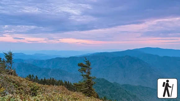
The Appalachian Trail and Boulevard route is built for views. You'll hike past Charlies Bunion, a jagged rock outcrop that offers some of the best vistas in the park, and the high ridges keep you in open terrain where the horizon stretches across wave after wave of blue mountains. The spruce-fir forest here feels otherworldly, especially when fog rolls in and turns the trail into a scene from a storybook. Photographers favor this route because the light shifts constantly as you move along the ridge, and the alpine zone holds color later into fall.

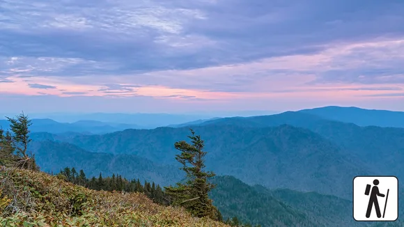
Bullhead keeps you in the forest longer, which means fewer sweeping panoramas but more intimate moments. The hardwood sections glow in mid-October when the maples and hickories peak, and the rhododendron tunnels bloom in late June, turning the trail into a corridor of pink and white. When you finally break onto Bullhead Ridge, the views hit harder because you've been climbing blind for hours. It's less about constant beauty and more about delayed gratification.
The AT shows you the Smokies from above; Bullhead makes you walk through them first.
The Crowds
The Appalachian Trail is one of the most famous footpaths in the world, and even though this section doesn't see the shoulder-to-shoulder congestion of the Alum Cave Trail, you won't be alone. Thru-hikers pass through from spring into early summer, and day hikers flock to Charlies Bunion year-round. The Boulevard spur thins the crowd a bit, but the summit of Le Conte still draws a steady stream from all five trails. Expect company at the top, especially on weekends.
Bullhead is the escape hatch. Most visitors who want Le Conte take Alum Cave because it's shorter, or Rainbow Falls because it's famous. Bullhead's length and lack of marquee features keep it quiet. You might see a handful of other hikers on a Saturday, and weekdays can feel nearly deserted. If solitude is your priority and you don't mind earning it through sheer mileage and elevation, this is your trail.
The AT brings you into the park's most storied corridor; Bullhead lets you vanish into the margins.
The Verdict
Both trails are long, both are hard, and both end at the same rocky summit. The Appalachian Trail and Boulevard route is the scenic choice: you start high, stay high, and spend most of your mileage in the kind of alpine terrain that defines the Smokies at their best. It's longer, but the grade is gentler, and the views arrive early and often. You'll share the experience with more hikers, but that's the trade-off for walking one of the most iconic stretches of trail in the East.
Bullhead is the grinder's route. It's shorter on paper but feels harder because the climb is relentless and the forest keeps you boxed in for hours. You won't see the crowds, and you won't get the postcard panoramas until you've earned them. If you're training for a thru-hike, testing your legs for a bigger objective, or just prefer the sound of your own breathing to the chatter of other hikers, this is the trail that delivers.
Which One Should You Choose?
Choose the Appalachian Trail and Boulevard route if you want ridgeline views, iconic trail mileage, and the chance to tick off Charlies Bunion on the same hike. It's the better choice for photographers, for hikers who prefer scenery over solitude, and for anyone who wants to say they walked a piece of the AT. The extra mileage is real, but the gentler grade and constant visual rewards make it easier to stomach.
Choose Bullhead if you want the trail to yourself, don't mind trading views for quiet, and have the legs to handle a steep, sustained climb. It's the smarter pick for endurance training, for hikers who find crowds draining, and for anyone who prefers to earn the summit through grunt work rather than mileage. You'll finish just as tired, but you'll have done it on your own terms.