The 8 Smallest National Parks (and Why They're Worth It)
The eight smallest national parks measure anywhere from a city block to the size of D.C., and they're worth every square foot
When you sort the national parks by size, the bottom of the list tells a different story than the top. These eight parks measure anywhere from smaller than a city block to roughly the size of Washington, D.C. What they lack in square mileage, they make up for in accessibility, specificity, and the kind of tight focus that sprawling wilderness parks can't match. You can visit most of these in a single day, and several sit within an hour of major airports.
April is an ideal month to visit nearly all of them. The thermal springs in Arkansas are less packed than summer, the tropical islands of American Samoa hit peak season, and the Virgin Islands dodge both spring break crowds and hurricane season. Even the urban monuments in St. Louis and the caves of South Dakota see comfortable temperatures before the summer rush.
Gateway Arch National Park
Smaller than many suburban lots / More visitors than Los Angeles has residents
The Gateway Arch is not a park in the sense that you might expect. It's a monument surrounded by groomed lawn along the Mississippi River, wedged into downtown St. Louis with sidewalks on all sides. You book a timed entry ticket to ride the tram to the top of the 630-foot arch, taller than the Washington Monument, and peer through narrow windows at the city grid below. The museum underground tells the story of westward expansion with artifacts and interpretive exhibits that give the monument context beyond its steel curves.
Gateway Arch National Park is what happens when you protect a single structure and the history it represents, not the wilderness around it.

The park draws more than three million visitors a year, making it one of the most visited in the system, and every single one of them funnels through the same tiny footprint. You'll stand in line for the tram unless you arrive when the park opens. The riverfront trails are pleasant enough for a short walk, but this is fundamentally an urban monument experience, not a hiking destination. Plan for two hours total, including the museum.
Hot Springs National Park
Eight historic bathhouses on one city street / Water bubbles up at 143 degrees
Hot Springs protects thermal water, not wilderness. The park runs through the middle of a small Arkansas city, where Bathhouse Row preserves eight ornate buildings that once catered to health tourists and gangsters alike in the early 1900s. You can tour the Fordyce Bathhouse, now a museum with stained glass, marble tubs, and gymnasium equipment that looks like medieval torture devices. Two bathhouses still offer traditional thermal baths where you soak in the same water that drew visitors a century ago.
The park's 40 miles of trails climb into forested mountains that feel surprisingly remote for a place where you can see traffic from the trailhead.
The Hot Springs Mountain Trail gains elevation quickly through oak and pine forest, reaching a fire tower with views over the Ouachita Mountains. The Promenade follows a paved path behind Bathhouse Row, connecting to dirt trails that branch into quieter terrain. April brings mild temperatures in the 70s and blooming dogwoods, making it one of the best months for hiking before the oppressive summer heat arrives. The park stays packed year-round, but the trail network spreads people out once you get past the first mile.
National Park of American Samoa
The only park south of the equator / Three volcanic islands in the South Pacific
Getting to American Samoa requires a commitment that most visitors never make. You fly from Honolulu to Pago Pago, a journey that crosses the international date line and lands you in a U.S. territory where Samoan language and fa'a Samoa culture shape daily life. The park protects tropical rainforest on volcanic slopes, coral reefs that drop into deep water, and traditional villages where extended families still hold communal land. Fewer people visit this park annually than Yellowstone sees in a single summer day.
You don't tour villages in American Samoa without permission, and the park respects that by requiring coordination with local communities before you hike certain trails.
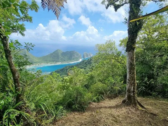
The Mount Lata Trail on Ta'ū Island climbs through rainforest to a ridge with views over the Pacific, passing massive banyan trees and fruit bats hanging in the canopy. Ofu Beach offers snorkeling over coral gardens where visibility reaches 100 feet on calm days. April falls during peak season when rainfall decreases slightly, though tropical weather means you'll likely see rain regardless. The park feels genuinely remote because it is, sitting closer to Samoa and Fiji than to any U.S. state.
Virgin Islands National Park
Two-thirds of St. John is protected / Sugar plantation ruins meet coral reefs
Most of St. John looks the way the Caribbean looked before resort development, with dense forest covering volcanic hills that drop straight into turquoise water. The park protects both terrestrial and marine environments, including an underwater snorkel trail at Trunk Bay where labeled plaques identify coral species and reef fish. Annaberg Plantation preserves stone ruins from the sugar industry that once dominated the island, complete with windmill towers and slave quarters that tell a darker history than the beach crowds acknowledge.
The underwater trail at Trunk Bay turns snorkeling into a guided tour, which sounds gimmicky until you realize how much you miss when you don't know what you're looking at.
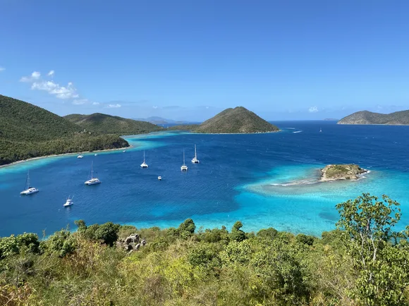
You reach St. John by ferry from St. Thomas, a 20-minute crossing that deposits you in Cruz Bay where the park visitor center sits a block from the dock. The Cinnamon Bay Loop climbs through forest thick with kapok and bay rum trees, passing petroglyphs left by Taíno people before European contact. April offers warm water and smaller crowds than the winter peak season, with temperatures in the low 80s and occasional brief showers. The park feels more accessible than American Samoa but still rewards exploration beyond Trunk Bay.
Indiana Dunes National Park
Fifteen miles of Lake Michigan shoreline / The system's highest plant biodiversity
Lake Michigan's wind built these dunes over thousands of years, piling sand into ridges that reach 150 feet above the water. What makes Indiana Dunes remarkable isn't the height but the diversity: more than 1,100 plant species grow here, from prickly pear cactus on sun-baked slopes to white pines in sheltered valleys. The Dunes Succession Trail shows you the progression from beach to forest in a three-mile loop that passes through distinct ecological zones separated by mere hundreds of feet.
You can see Chicago's skyline from the beach, which makes the patches of genuine wilderness feel like they're hiding in plain sight.

The park sits 30 miles from downtown Chicago, making it one of the most accessible in the system for major urban populations. That accessibility brings crowds, especially on summer weekends when the beaches fill to capacity by mid-morning. April offers mild weather in the 60s and far fewer people, though Lake Michigan stays too cold for comfortable swimming until June. The West Beach Loop and Miller Woods Trail both lead through dune ecosystems without the steep climbs of Mount Jackson, making them ideal for families.
Congaree National Park
Largest old-growth bottomland forest in the Southeast / Champion trees you reach via boardwalk
Congaree protects the kind of forest that once covered much of the coastal plain before logging, agriculture, and development cleared it away. Bald cypress and water tupelo trees rise from a floodplain that goes underwater when the Congaree River swells, creating a swampy environment where you walk on elevated boardwalks to stay dry. Several trees here hold state or national records for height and girth, their trunks buttressed at the base like Gothic columns.
The boardwalk loop feels like walking through a flooded cathedral where the ceiling is 150 feet overhead and the silence is broken only by woodpecker taps.
Most people walk the 2.4-mile Boardwalk Loop and leave, which means the park's longer trails through the backcountry stay remarkably quiet despite Congaree sitting just 20 miles from Columbia. April brings comfortable temperatures in the 70s and blooming wildflowers, before the summer heat and humidity make the forest feel like a steam room. The park offers ranger-led canoe tours through flooded sections when water levels permit, putting you at eye level with cypress knees and tannic water that reflects the forest like a mirror.
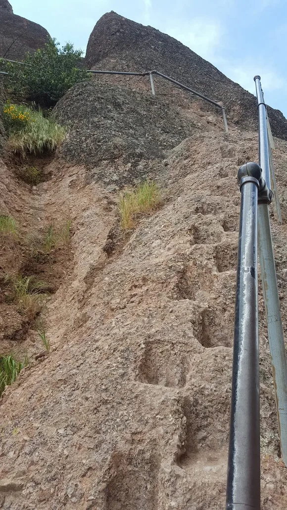
Pinnacles National Park
Volcanic spires you can climb through / Half of Yosemite's crowds
Pinnacles formed from an ancient volcano that erupted 23 million years ago, then split apart as tectonic forces moved half of it 195 miles south to its current location. What remains are rock spires rising above chaparral-covered hills, creating dramatic formations that look more like a western movie set than a volcanic remnant. The Bear Gulch Caves route takes you through talus caves formed by fallen boulders, where you crawl through narrow passages in near darkness before emerging into daylight.
The High Peaks Trail isn't technically difficult, but the narrow passages carved into steep rock with sheer drops on both sides will test anyone afraid of heights.
Pinnacles sits 90 miles south of San Jose in California's Coast Ranges, far enough from major population centers to avoid the kind of crowding that plagues Yosemite. April offers ideal conditions, with temperatures in the 70s and wildflowers blooming across the hillsides. By summer, the mercury regularly hits the low 90s and the chaparral turns brown. The park has no through road connecting the east and west entrances, so you commit to one side when you arrive. California condors, reintroduced here after near extinction, soar over the spires with nine-foot wingspans.
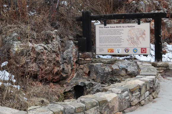
Wind Cave National Park
One of the world's longest caves / Mixed-grass prairie above, limestone maze below
Wind Cave extends for more cave miles than most parks have surface trails, though visitors see only a fraction during ranger-led tours that descend into chambers decorated with boxwork, a delicate calcite formation found in few other caves worldwide. The cave's name comes from wind that rushes in and out of the natural entrance, equalizing pressure between the underground passages and the surface. Above ground, mixed-grass prairie supports bison herds that graze alongside prairie dogs whose towns create habitat for burrowing owls.
You can't explore Wind Cave on your own, which frustrates independent hikers but protects formations that would be destroyed by unguided traffic.
The park sits in South Dakota's Black Hills, 65 miles south of Rapid City and close enough to Mount Rushmore that many visitors combine them in a single trip. April can be unpredictable, with temperatures ranging from the 40s to the 70s and occasional spring snowstorms. The cave stays at a constant 54 degrees year-round, making a light jacket advisable regardless of surface weather. Surface trails through the prairie offer wildlife viewing without the crowds that pack the cave tours, especially early morning when bison are most active.