Sequoia & Kings Canyon National Parks

Timber Gap Trail

moderate Solitude SeekersHistory BuffsForest Bathing
4 mi Distance
Varies Estimated Time
roundtrip Trail Type

What to Expect

Timber Gap Trail follows the bones of an old mining route, and it feels like it — the path has that purposeful, no-nonsense grade that miners carved when they had ore to haul, not scenery to admire. You'll climb steadily along Monarch Creek through a cathedral of red fir, the kind of forest where the canopy swallows most of the sunlight and the air drops ten degrees. The trail gains real elevation over its two miles to the gap, so don't let the 'moderate' label fool you into flip-flops. As the trees thin near Timber Gap itself, the reward lands: sweeping views north into the Middle Fork Kaweah River drainage, a wild tangle of granite and green that most Sequoia visitors never glimpse. This one belongs to hikers who appreciate a quiet forest walk with a vista payoff and zero crowds.
Solitude SeekersHistory BuffsForest BathingPhotographersCool Escapes

Safety Advisory

Mineral King Road is narrow, steep, and has over 600 curves — take it slow, especially on the descent when brakes heat up. Not suitable for large RVs or trailers.

Snow lingers at these elevations well into June most years. The trail near the gap can be obscured by snowpack, so carry a map and check conditions at the ranger station before heading out.

Trail Details

Distance 4 miles round-trip
Difficulty moderate
Estimated Time Varies
Trail Type roundtrip
Pets Not allowed
Season Year-round
Trailhead Timber Gap Trail

Pro Tips

Trail Tip

Start from the Mineral King Road trailhead early — the road itself is a white-knuckle, hour-plus drive from Three Rivers, so factor that into your morning and don't plan a tight turnaround.

Trail Tip

Marmots in the Mineral King area are infamous for chewing radiator hoses and wiring on parked cars. Wrap your engine compartment with a tarp and tuck it under the tires — locals do this religiously.

Trail Tip

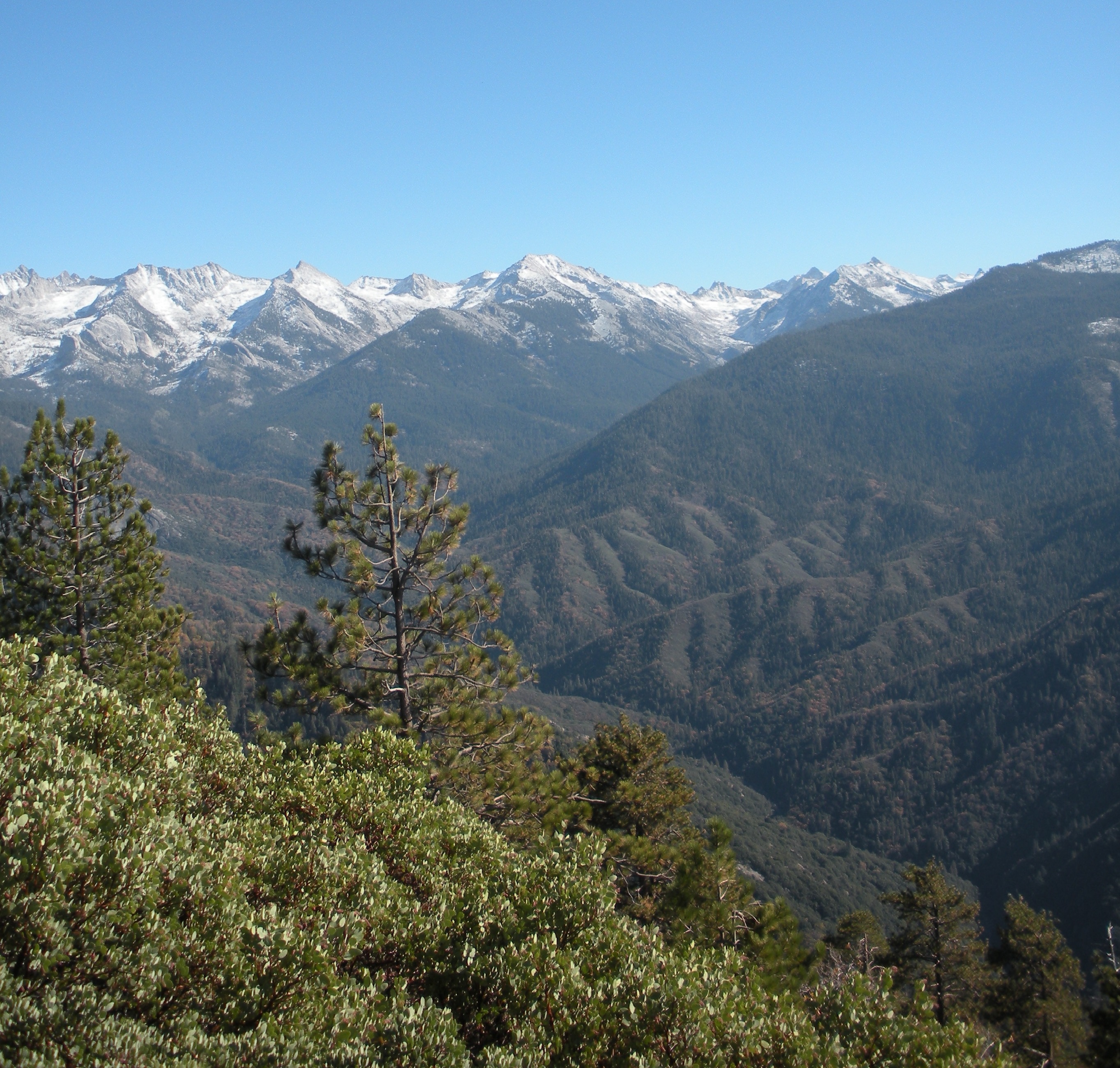
The gap itself makes a natural lunch spot with north-facing views, but walk a few minutes past it for even better vantage points into the Kaweah drainage where you can see layers of ridgelines stacking up.

More Trails in Sequoia & Kings Canyons

Explore Sequoia & Kings Canyon National Parks

15 campgrounds, 100 trails, 2.0M annual visitors

View Park Guide