8 National Parks With the Highest Trail Density
Eight parks where trail miles outnumber the crowds, from Alaskan wilderness to tropical islands you've never heard of
Trail density is the stat nobody talks about but everyone should. It measures how many trail miles exist per square mile of parkland, and it tells you whether you're about to share switchbacks with a tour group or disappear into country where the map is just a suggestion. The eight parks on this list pack enough trail mileage into their boundaries to make crowding nearly impossible, even if you tried.
Most are household names you've never heard of. All of them offer something the famous parks can't: elbow room.
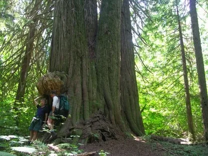
North Cascades National Park
103 trails in an area smaller than Rhode Island / Three hundred glaciers you can actually reach
North Cascades crams more trail miles into less space than any park in the system. You'll find routes to hanging valleys, ice fields, and alpine tarns that would take a week to reach in Alaska but sit just a few miles off the highway here. The sheer density of options means you can pick a different trail every day for three months and still not cover them all. Most people drive the North Cascades Highway, snap a photo at Diablo Lake, and leave without ever lacing up boots. Their loss.
Three hours from Seattle and you're in terrain that looks like the Alps, except you'll have it to yourself.
Cascade Pass Trail delivers the full alpine payoff in under four miles, with glacier views that rival anything in the Rockies. If you want solitude, push on to Sahale Arm, where most day hikers turn back and the real North Cascades begins. August brings the best weather, but June offers wildflowers thick enough to look photoshopped. Snow lingers on high passes into July, so check conditions before committing to anything above 5,000 feet.
Isle Royale National Park
65 trails across a roadless Lake Superior island / Fewer annual visitors than Yellowstone gets in a day
Isle Royale is the national park for people who think national parks have gotten too accessible. You reach it by ferry or seaplane, spend your nights in backcountry shelters or tent sites, and hike trails that follow ridgelines above water so clear you can see shipwrecks from shore. The trail network here feels like it was designed by backpackers for backpackers: long ridge traverses, connecting loops, and enough mileage to disappear for a week without retracing your steps.
The wolves and moose get more press, but the real draw is 165 miles of trail where the only sounds are loons and your own breathing.
Greenstone Ridge Trail runs the length of the island along the high spine, offering Lake Superior views in both directions when the fog lifts. Most backpackers tackle it in four to five days, camping at established sites that fill up fast in July and August. The Minong Ridge alternate is tougher, less maintained, and almost empty. You'll find blueberries thick enough to slow your pace in late summer and moose tracks in the mud every morning.
Katmai National Park & Preserve
Bigger than Connecticut with trails you won't find on any map / 2,200 brown bears and barely any people
Katmai's trail count undersells the experience. Most visitors fly in for a day at Brooks Falls, watch bears snatch salmon from the air, and fly back out without realizing the park holds country vast enough to swallow Rhode Island twice over. The established trails stick close to Brooks Camp and the Valley of Ten Thousand Smokes, but the real hiking happens off-trail through tundra and volcanic ash that hasn't seen footprints since last summer.
This is the rare park where the bears have right of way and humans are the ones who need to make noise and yield.
The Valley of Ten Thousand Smokes bus drops you at the edge of a lunar landscape carved by the 1912 Novarupta eruption, still the largest volcanic event of the 20th century. From there you can day hike to the vent or commit to multi-day routes through ash fields that look like the surface of Mars. June offers the longest daylight and fewest mosquitoes, though the bears concentrate at the falls in July when salmon runs peak.
Kobuk Valley National Park
Sand dunes the size of Manhattan above the Arctic Circle / No roads, no trails, no cell service
Kobuk Valley's trail count is misleading because most of the park doesn't have trails in the traditional sense. You navigate by tundra, river, and sand, following caribou paths and gravel bars through country that looks nothing like what you'd expect from Alaska. The Great Kobuk Sand Dunes rise 100 feet above boreal forest, a leftover from the last ice age that glaciers somehow missed.
Hiking sand dunes in a place where the sun doesn't set in summer feels like a geography glitch.
Reaching the dunes requires a floatplane or riverboat from Kotzebue, followed by a paddle or hike depending on water levels. Most visitors come in late August when the Western Arctic caribou herd migrates through, sometimes half a million strong. You'll camp wherever you drop your pack, filter water from the Kobuk River, and navigate by landmarks because GPS batteries die fast in the cold.
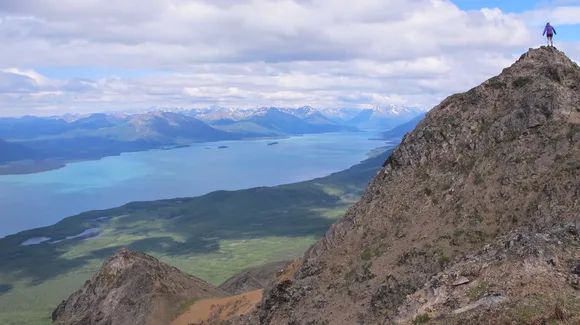
Lake Clark National Park & Preserve
Two active volcanoes and a 42-mile glacial lake / Across Cook Inlet from Anchorage but feels a world away
Lake Clark calls itself the "Alaskan Alps" and the comparison holds. Jagged peaks drop straight into turquoise water, glaciers calve into valleys thick with brown bears, and the trail system stitches together enough terrain variety to keep you busy for weeks. Like most remote Alaskan parks, the established trails are just suggestions. Once you're off the floatplane, the country opens up and you pick your own line.
You can see Lake Clark from Anchorage on clear days, but reaching it requires a flight over some of the roughest water in Alaska.
Twin Lakes Trail cuts through tundra and spruce forest to a drainage famous for bear viewing, while Portage Valley Trail climbs to glacier overlooks that rival anything in Denali. The lake itself stretches longer than Lake Tahoe, with kayaking routes that take days to paddle and fishing that draws anglers willing to spend serious money on floatplane charters. June offers the most stable weather before the summer monsoons roll in.
National Park of American Samoa
The only park south of the equator / Rainforest trails that end at coral reefs
American Samoa packs 28 trail miles into an area smaller than many city parks, but the density works because the terrain is so varied you'll forget you're on an island. Routes climb from sea level through rainforest to volcanic ridges, then drop back down to beaches where the snorkeling rivals anything in the Pacific. Mount Lata Trail is the crown jewel: six miles through jungle so thick you can't see more than 20 feet in any direction, ending at a summit overlooking three islands.
You'll sweat through your shirt in the first mile and wonder why you didn't just stay at the beach, then reach the ridge and understand.
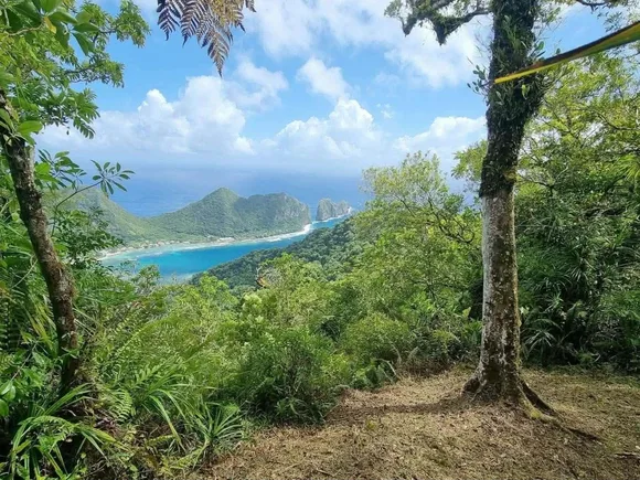
Ofu Beach sits at the far end of the park's trail network, a crescent of white sand against water so blue it looks filtered. The coral reef just offshore is what the whole Pacific looked like before development and warming took their toll. February through May offers the driest weather, though "dry" is relative in a rainforest where afternoon showers are the norm year-round.
Wrangell-St. Elias National Park & Preserve
Larger than Switzerland with just 70 miles of maintained trail / Nine of North America's 16 highest peaks
Wrangell-St. Elias is the opposite of North Cascades: massive acreage with relatively few formal trails, but the trails that exist access terrain you won't find anywhere else in the Lower 48. Root Glacier Trail lets you walk onto ice fields without technical gear, while the McCarthy Road itself functions as a 60-mile adventure before you even reach the park boundary. Most of the hiking happens off-trail through country so remote that search and rescue might take days.
America's largest park has fewer maintained trail miles than most state parks, and that's exactly the point.
The Kennecott Mines area offers the most accessible trails, with routes to glaciers, alpine passes, and abandoned copper processing buildings that look like they belong in a post-apocalyptic film. June brings the midnight sun and stable weather before the July crowds arrive. By August the blueberries ripen and the autumn colors start, but the bugs thin out enough to make bushwhacking tolerable.
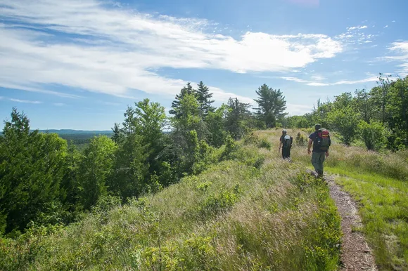
Great Basin National Park
50 trails climbing from desert to alpine in five miles / Bristlecone pines older than the pyramids
Great Basin condenses more elevation zones into less space than almost any park outside Alaska. You'll start in sagebrush desert, climb through aspen groves and conifer forest, and summit Wheeler Peak above treeline in a single day hike. The trail network here is dense enough that you can spend a week without repeating routes, yet the park draws fewer visitors annually than Zion sees in a busy weekend.
Wheeler Peak looks like a Colorado fourteener but sits in Nevada, which confuses people until they realize elevation doesn't respect state lines.
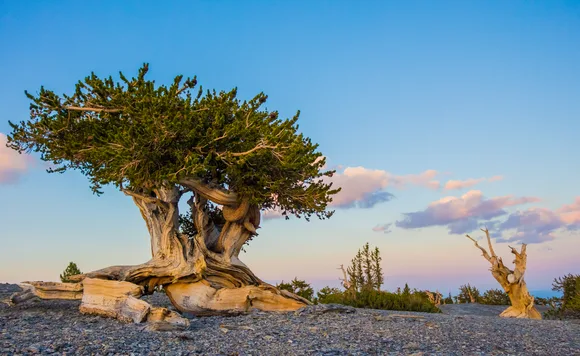
Bristlecone Pine Trail leads to trees that were already ancient when Rome fell, twisted and stripped by wind into shapes that look like sculpture. Lehman Caves offers a break from the heat with marble formations and ranger-led tours that book up fast in summer. The high country holds snow into June, but by July the wildflowers peak and the alpine lakes warm enough for a quick swim if you're brave.