8 National Parks With the Most Dramatic Elevation
These eight parks drop from alpine summits to valley floors, coastlines, or lava fields — offering more vertical relief than entire mountain ranges
Elevation change isn't just a number on a trail sign. It determines how hard your lungs work, which ecosystems you cross, and whether you're hiking through wildflowers or strapping on crampons. The parks on this list offer more vertical relief than most mountain ranges, dropping from alpine summits to tide pools, volcanic craters, or valley floors thousands of feet below.
Most people think elevation gain matters only to climbers. But the parks with the most dramatic vertical relief pack multiple climate zones into a single visit. You can watch caribou on tundra in the morning and stand next to tidewater glaciers by afternoon, or hike from sequoia groves to alpine lakes in the same day. That vertical diversity is what makes these eight parks worth the climb.
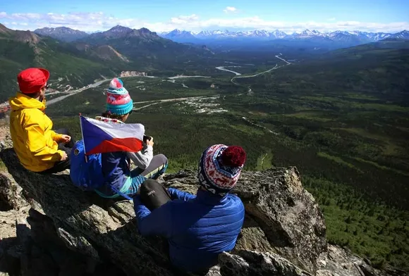
Denali National Park & Preserve
North America's tallest peak, 20,310 feet above sea level / The size of Vermont / Almost nobody here
Denali holds the continent's most extreme elevation span: from the Tanana River lowlands at around 300 feet to the summit of Denali itself at 20,310 feet. That's more vertical relief than anywhere else in the United States, and you feel it in the ecosystems. The park road winds through boreal forest, crosses alpine tundra where caribou outnumber hikers, and offers views of glaciers spilling down from ice fields that stretch for miles. Most visitors never leave the single road corridor, which means the backcountry stays genuinely empty.
The mountain makes its own weather, and on most days it hides behind clouds that stretch across the Alaska Range like a curtain.
April sits at the edge of the season here. The park road doesn't open to vehicles beyond mile 30 until mid-May, and snow still blankets the high country. But if you're willing to ski or snowshoe, you'll have the kind of solitude that doesn't exist in summer. The only downside: Denali reveals itself to fewer than 30 percent of visitors, even in peak season. Spring cloud cover is relentless.
Wrangell-St. Elias National Park & Preserve
Larger than Yellowstone, Yosemite, and Switzerland combined / Nine of the continent's sixteen highest peaks
Wrangell-St. Elias holds more extreme topography than any park in the system. Mount St. Elias rises 18,008 feet directly from the Gulf of Alaska, creating one of the steepest coastal relief zones on Earth. The park's vertical range spans from sea level to summits above 16,000 feet, and the McCarthy Road delivers you to glaciers you can walk on without technical gear. Root Glacier Trail puts you on ice within three miles of the trailhead, and if you bring microspikes, you can wander onto the glacier itself.
The park absorbs fewer visitors than a busy weekend at Yosemite Valley, despite being six times the size of Yellowstone.
Most people miss Wrangell-St. Elias entirely because it requires commitment. There are no paved roads inside the park, and the McCarthy Road cuts through sixty miles of washboard gravel before you reach the old mining town. But that remoteness keeps the crowds away. You can hike for days without seeing another person, and the Bagley Icefield holds more ice than most states have lakes.
Glacier Bay National Park & Preserve
Fifteen tidewater glaciers calving into a 65-mile fjord / No roads, boat or plane access only
Glacier Bay's elevation change plays out vertically and horizontally. The Fairweather Range rises more than 15,000 feet within ten miles of the coastline, and glaciers tumble from ice fields down to the bay in cascades of blue ice. You can't drive here, which keeps the experience focused on boats and kayaks. The park's tidewater glaciers calve directly into the fjord, sending waves rolling across the water and drawing humpback whales that feed in the nutrient-rich currents.
Glaciers here have retreated more than sixty miles in the past 250 years, rewriting the map faster than anywhere else in Alaska.
April sits at the shoulder of the season. Cruise ships don't arrive until May, and the park's boat tours operate on limited schedules. But the lack of crowds means you can explore Bartlett Cove's rainforest trails without competing for space, and brown bears emerge from dens to feed along the shoreline. The weather stays cool and wet, but you're in Southeast Alaska — it rains no matter when you visit.
Hawaiʻi Volcanoes National Park
From sea level to 13,681 feet on Mauna Loa / More trail miles than the entire island of Maui
Hawaiʻi Volcanoes drops you into terrain that didn't exist 500 years ago. The park spans from the coast to the summit of Mauna Loa, the world's most massive volcano, covering more than 13,000 feet of elevation. You can hike across the Kīlauea Iki crater floor in the morning — walking on lava that was molten in 1959 — and drive to alpine desert on Mauna Loa by afternoon. The Thurston Lava Tube takes kids through a tunnel carved by flowing lava, and the Chain of Craters Road descends 3,700 feet to the coast in a series of switchbacks that cut through decades of lava flows.
The park adds new land every time lava reaches the ocean, making it one of the few places on Earth that's still growing.
April is the park's quietest month, which makes it the best time to visit if you want elbow room on the trails. The weather stays mild year-round, with temperatures in the 70s at lower elevations and cooler conditions at the summit. Kīlauea's crater glows at night when the lava lake is active, and the lack of cruise ship crowds means you can watch the glow without sharing the overlook with hundreds of other people.
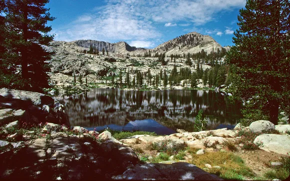
Sequoia & Kings Canyon National Parks
From foothills at 1,370 feet to Mount Whitney at 14,505 feet / More trail miles than Vermont has paved roads
Sequoia and Kings Canyon pack more elevation relief into the Sierra Nevada than any other park in the range. The parks stretch from hot chaparral foothills to the alpine summit of Mount Whitney, the tallest peak in the Lower 48. That vertical span creates a ladder of ecosystems: you pass through oak woodlands, giant sequoia groves, mixed conifer forests, and finally granite basins where snow lingers into July. The General Sherman Tree sits in the middle of that gradient, and the Moro Rock Trail climbs 400 granite steps to a viewpoint that drops away 4,000 feet into the Central Valley.
Kings Canyon's granite walls rival Yosemite for sheer vertical relief, but you'll share the trails with a fraction of the crowds.
The park stays uncrowded even in summer, and the size absorbs visitors into backcountry that rarely sees overnight traffic. The High Sierra Trail connects Crescent Meadow to Mount Whitney in a 60-mile traverse that crosses every major life zone in the Sierra. April catches the parks before the roads fully open — Mineral King Road and parts of the Kings Canyon Scenic Byway stay closed until late May — but the lower elevation trails around the Giant Forest remain accessible.
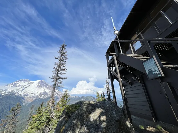
Mount Rainier National Park
Summit at 14,410 feet / More glacial ice than all other Cascade peaks combined
Mount Rainier holds more glaciers than any peak in the Lower 48, and the elevation drop from summit to valley creates a conveyor belt of meltwater that feeds five major river systems. The mountain rises 13,000 feet from its base in a single massive cone, and you feel the elevation gain on every trail. Paradise sits at 5,400 feet but gets buried under more than 50 feet of snow most winters, and the Skyline Trail climbs through subalpine meadows that bloom with wildflowers from late July through August.
The summit looms over Seattle like a monument, visible on clear days from 100 miles away.
April keeps the high country locked under snow, but the lower elevation trails around Longmire and the Grove of the Patriarchs remain accessible. The Trail of the Shadows loops through old-growth forest and mineral springs, and Narada Falls drops 168 feet through a mossy gorge that stays green year-round. Kids can earn Junior Ranger badges at the visitor centers, and the relatively mild temperatures at lower elevations make spring a good season for families.
Death Valley National Park
Badwater Basin at 282 feet below sea level / Telescope Peak at 11,049 feet / Largest park in the Lower 48
Death Valley holds the lowest point in North America and a summit that climbs more than 11,000 feet above it, creating an elevation span that rivals parks three times its size. You can stand at Badwater Basin and look up at Telescope Peak looming nearly two vertical miles above the salt flats. The climb to Telescope Peak gains more elevation than most 14ers in Colorado, and the trail crosses through five distinct life zones: from creosote desert to pinyon-juniper woodland to bristlecone pine forests near the summit.
The valley's heat is a real threat, not a marketing slogan — ground temperatures exceed 200F in summer, hot enough to blister exposed skin.
April sits at the edge of the comfortable season. Daytime temperatures in the valley hover in the 80s, which is warm but manageable compared to the 120-degree furnace that arrives by June. Families can walk out onto the Badwater salt flats without risking heat exhaustion, and the Golden Canyon Trail offers slot canyon hiking through walls of yellow rock that glow in late afternoon light.
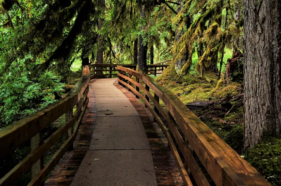
Yosemite National Park
Valley floor at 4,000 feet / Ridgelines at 13,000 feet / More waterfalls than any park in the system
Yosemite's granite walls rise 3,000 feet from the valley floor in sheer vertical cliffs, creating the kind of relief that draws climbers from around the world. Half Dome's summit sits nearly 5,000 feet above the Merced River, and the hike to the top gains more elevation than most people climb in a year of hiking. The valley concentrates the drama, but the high country around Tuolumne Meadows offers alpine terrain above 10,000 feet where snow lingers into July and granite domes rise like islands from meadows filled with wildflowers.
Yosemite Falls drops 2,425 feet in three separate cascades, making it the tallest waterfall in North America when measured top to bottom.
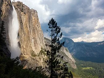
April catches the waterfalls at peak flow. Yosemite Falls, Bridalveil Fall, and Vernal Fall run with snowmelt that turns the valley into a thundering amphitheater of white water. The Mist Trail lives up to its name — you'll get soaked climbing the granite steps next to Vernal Fall. Families can take the valley shuttle to explore the park without fighting for parking, and the Junior Ranger program keeps kids engaged between waterfall stops.