The 7 Most Underrated National Parks (According to the Numbers)
Seven national parks that combine genuine remoteness with accessibility, drawing fewer visitors than most state parks
The national park conversation fixates on the same dozen names while fifty others sit empty. This list isolates seven parks that combine genuine remoteness with accessibility you can actually plan around. The common thread: each draws fewer visitors than most state parks despite offering terrain you won't find anywhere else in the system.
We ranked parks by comparing visitor numbers to their size, accessibility, and what they offer. The gap between what you'll experience and how many people know about it tells the story.
North Cascades National Park
More glaciers than the rest of the Lower 48 combined / Three hours from Seattle / Almost nobody goes
North Cascades holds over three hundred glaciers in jagged alpine terrain that looks more like the Himalayas than Washington State. The park sits closer to Seattle than Mount Rainier, yet draws fewer visitors in a year than Rainier sees on a summer weekend. Most people have never heard of it. Those who have tend to be climbers, backpackers, and photographers chasing the kind of backcountry solitude that vanished from the Cascades decades ago.
The North Cascades Scenic Highway delivers alpine drama without the crowds that clog Going-to-the-Sun Road.
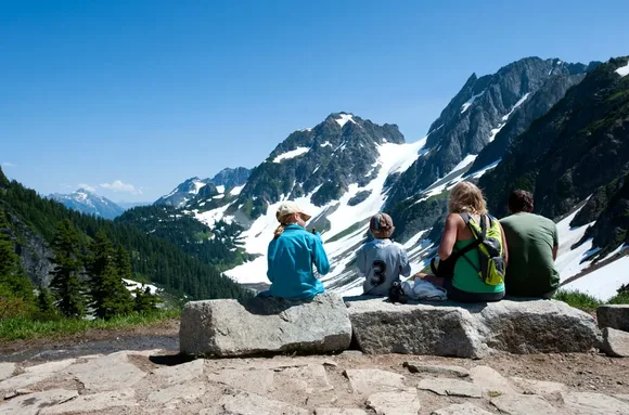
Diablo Lake glows an unnatural turquoise from glacial flour suspended in the water. You can see it from pullouts along Highway 20, or hike the Diablo Lake Trail for seven miles of shoreline views without the tour buses. Cascade Pass offers a moderate hike to subalpine meadows with Mount Shuksan looming above. The trailhead fills by mid-morning in August, but the valley beyond holds days of trail where you won't see another person.
Isle Royale National Park
No roads, no cell service, wolves and moose sharing trails / Ferry or seaplane only
Isle Royale floats in Lake Superior like an experiment in what national parks looked like before cars. You reach it by ferry from Michigan or Minnesota, or by seaplane if you're committed. Once you're on the island, you're walking. The park protects the longest-running predator-prey study in the world, tracking wolves and moose across boreal forest that feels more like Canada than the Midwest.
Isle Royale demands commitment before you even arrive, which filters out everyone looking for a drive-through experience.
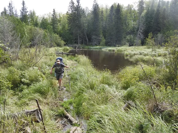
The Greenstone Ridge Trail runs the length of the island for 28 miles, connecting backcountry camps where you'll sleep to the sound of loons. Minong Ridge offers a more rugged alternative with rocky scrambles and expansive views across the island's ridgeline. Rock Harbor sits on the eastern end with a visitor center, lodge, and access to shorter day hikes. Most visitors stay three to five days, which tells you something about the park's pace.
Katmai National Park & Preserve
More brown bears than people / Brooks Falls draws the cameras / The backcountry stays empty
Katmai protects North America's largest concentration of brown bears, with over two thousand living across volcanic terrain the size of Wales. Brooks Falls gets the attention every July when bears line up to catch salmon mid-leap, but that single platform represents a fraction of what the park offers. The Valley of Ten Thousand Smokes spreads ash and pumice across 40 square miles from the 1912 eruption of Novarupta, the largest volcanic blast of the 20th century.
Brooks Falls works as reality television because the bears ignore you completely, focused entirely on salmon.
You reach Katmai by floatplane from King Salmon, which adds cost but eliminates the crowds that plague road-accessible parks. Most visitors fly in for the day to see Brooks Falls, but the park maintains trails and backcountry camps for those willing to stay longer. Naknek Lake stretches for 40 miles with kayaking access and fishing that rivals anywhere in Alaska. The bears fish the streams, you fish the lake, and the system works.
Lake Clark National Park & Preserve
Two active volcanoes / 42-mile glacial lake / No roads, just floatplanes and your boots
Lake Clark combines every Alaska landscape into one park you can only reach by air. Mount Redoubt and Mount Iliamna steam above turquoise lakes fed by glaciers that still carve valleys through the Chigmit Mountains. Brown bears fish salmon streams that have never seen a road. The park sits 100 air miles from Anchorage but operates on backcountry rules: bring what you need, leave nothing behind, and understand that weather can strand you for days.
Lake Clark feels like Alaska before the parks system codified wilderness into visitor centers and marked trails.
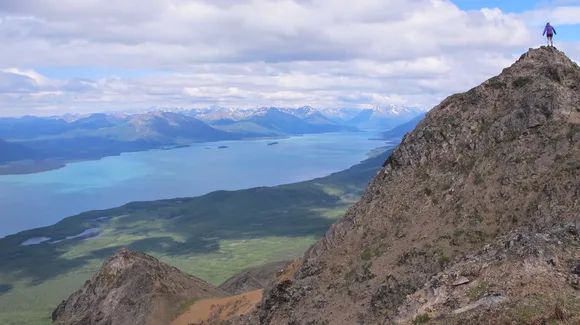
Twin Lakes anchors the interior with hiking access to alpine valleys and wildlife viewing that includes caribou, Dall sheep, and the occasional wolf. Telaquana Lake sits farther north with fishing and paddling routes that connect to remote camps. Most visitors hire guides for fishing or bear viewing, but independent backpackers can arrange drop-offs for multi-day trips into terrain that sees fewer people per year than Yosemite sees per hour.
Dry Tortugas National Park
Coral islands 70 miles past Key West / Massive fort that was never fired upon / Clearest water in the park system
Dry Tortugas floats in the Gulf of Mexico as seven coral islands anchored by Fort Jefferson, a hexagonal brick fortress that took 30 years to build and never saw combat. The fort sits on Garden Key with snorkeling reefs, camping sites, and views across water so clear you can see coral heads from the seawall. You reach it by ferry or seaplane from Key West, which keeps crowds manageable even in peak season.
Fort Jefferson holds more bricks than any structure in the Western Hemisphere, all hauled by ship to build a prison that held Lincoln assassination conspirators.
The snorkeling rivals anything in the Caribbean, with elkhorn coral, sea turtles, and tropical fish circling the moat wall. The fort itself offers ranger programs and self-guided tours through casemates and powder magazines. Camping on Garden Key puts you on an island with sunset views and night skies that convinced astronomers to map stars from this exact spot in the 1800s. The ferry runs daily with limited capacity, so you'll never experience the shoulder-to-shoulder crowding of mainland Florida parks.
Wrangell-St. Elias National Park & Preserve
Larger than Switzerland / Nine of the continent's sixteen highest peaks / Glaciers you can drive to
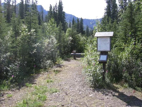
Wrangell-St. Elias sprawls across terrain six times larger than Yellowstone, holding more glaciers and higher peaks than any park in the system. Mount St. Elias rises from tidewater to over three miles high in under ten horizontal miles, creating one of the steepest elevation gains on Earth. The McCarthy Road runs 60 miles of gravel into the park's interior, ending at the historic mining town of McCarthy and the abandoned Kennicott mill complex.
The park's sheer size absorbs visitors like a glacier absorbs snow—you can drive for hours and never see another car.
Root Glacier offers hiking access directly from Kennicott, with ice caves and crevasses you can explore with crampons and a guide. The Kuskulana Glacier Trail provides a shorter option with views across the Chitina River valley. Most visitors spend two to three days exploring McCarthy and Kennicott, but backcountry routes extend for weeks across terrain that sees maybe a dozen people per season. The coastal section along Icy Bay holds active tidewater glaciers calving into the Gulf of Alaska.
Congaree National Park
Largest old-growth bottomland forest left / Champion trees you can walk beneath / 20 miles from Columbia
Congaree protects floodplain forest that survived logging because the land flooded too often to build mills. The result: cathedral groves of bald cypress, loblolly pine, and sweetgum that tower overhead like the redwood forests of the East Coast. The Boardwalk Loop runs two miles through standing water and moss-draped canopy, accessible enough for strollers but wild enough to feel remote.
Congaree's champion trees grow so tall you'll crane your neck to see the canopy, then wonder how forests this old survived into the 21st century.
The park sits 20 miles from South Carolina's capital, yet few people know it exists. Ranger programs run throughout the year, including firefly displays in May when synchronous species light the forest floor. Kayaking the Cedar Creek Canoe Trail offers a different perspective through flooded forest where you'll paddle beneath champion trees reflected in black water. The park stays open year-round with mild winters and humid summers that drive most visitors to spring and fall.