The Alaska national parks road trip
Four Alaska parks anchor a 600-mile route from tidewater glaciers to Denali, skipping the cruise ships for the road less driven
Most people think of Alaska's national parks as a fly-in proposition, but four of them anchor a driving route that stretches from Anchorage to Fairbanks. You'll cover more than 600 miles through the interior, past ghost towns and along the Parks Highway, where the scenery shifts from tidewater glaciers to subarctic tundra. June opens the road season with near-constant daylight and wildflowers, before the cruise ship crowds peak in July.
This isn't a loop. You'll start in Anchorage, work your way south to the Kenai Peninsula, backtrack through Anchorage, then push north through Wrangell-St. Elias and Denali before ending in Fairbanks. Plan for at least ten days if you want to do more than windshield time, and know that you're trading convenience for access to parks most Americans have never heard of.
Kenai Fjords National Park
The only glacier in Alaska you can drive to / Exit Glacier retreat markers tell a grim story
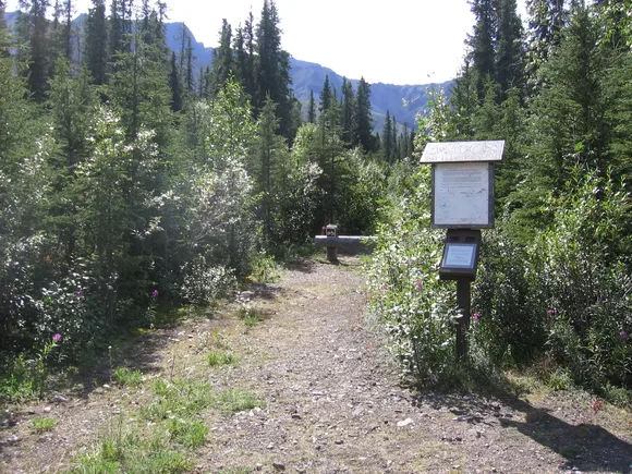
Exit Glacier sits at the end of a paved road just outside Seward, where painted markers along the trail show where the ice stood in decades past. The 1815 marker sits nearly a mile from the current terminus. You can walk right up to the face on a network of trails that range from a flat half-mile loop to the Harding Icefield Trail, an eight-mile climb that gains more elevation than most Colorado fourteeners. The icefield trail delivers what it promises: a sprawling plateau of ice that feeds dozens of glaciers, all of it visible from a rocky overlook where you'll want layers even in June.
The retreat markers at Exit Glacier read like a timeline of climate change, each one a painted reminder that the ice isn't coming back.

Seward serves as the gateway for boat tours into the fjords themselves, where tidewater glaciers calve into the ocean and humpback whales surface close enough to hear them exhale. The tours book up weeks in advance during summer, but the park's real draw is the accessibility. Families with toddlers walk to the glacier overlook while backpackers disappear into the backcountry along the coast. June brings mild temperatures in the low 60s and fewer tour buses than July, though rain gear isn't optional in a maritime climate.
Wrangell-St. Elias National Park & Preserve
Larger than Switzerland / Nine of North America's sixteen highest peaks
America's biggest national park absorbs visitors the way the ocean absorbs raindrops. You could spend a month here and never cross paths with another hiker. The McCarthy Road, a 60-mile gravel route that follows an old railroad grade, delivers you to the historic mining towns of McCarthy and Kennicott, where buildings from the early 1900s sit frozen in time against a backdrop of the Wrangell Mountains. The Root Glacier Trail starts just past Kennicott, an easy six-mile round trip that puts you on the ice without technical gear, though crampons help if you want to explore the crevasses and ice caves.
Wrangell-St. Elias doesn't reveal itself from a pullout — you have to commit to the drive, the dust, and the knowledge that help is hours away.
The park holds more glaciers than most states have lakes, including the Bagley Icefield, which sprawls across the interior like a frozen inland sea. Mount St. Elias rises straight from the coast to over 18,000 feet, creating weather systems that dump snow year-round. Most visitors stick to the McCarthy area, but if you're willing to navigate rougher roads, the Nabesna Road in the northern section offers another 40 miles of access through gold rush country. June brings wildflowers and manageable creek crossings, before the summer melt turns streams into torrents.
Denali National Park & Preserve
North America's tallest peak / One 92-mile road into six million acres
Denali the mountain hides more often than it shows. Clouds shroud the summit roughly two-thirds of summer days, which means you plan your entire trip around a peak you might never see. The park itself sprawls larger than Massachusetts, but only one road penetrates the interior, and private vehicles can't drive past mile 15. You'll board a park bus for the rest, a six-to-eight-hour round trip that delivers grizzly sightings, caribou herds, and the kind of tundra vistas that make you understand why Alaska feels like a different country.
The bus driver stops for wildlife, not schedules — which means your six-hour trip might stretch to eight if a grizzly decides to nap on the road.
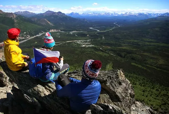
Wonder Lake at mile 85 offers the classic postcard view when the mountain cooperates, but the backcountry is where Denali separates itself from other parks. There are no marked trails in the wilderness zones. You pick a drainage, file a permit, and navigate by map and terrain. The front country trails near the entrance, like the Mount Healy Overlook, climb steeply through spruce forest to alpine tundra with views across the Alaska Range. June brings 20-plus hours of daylight and wildflowers, though mosquitoes claim their share of exposed skin. The park's size absorbs the crowds, even during peak season, which says something about how much empty space six million acres actually holds.
Glacier Bay National Park & Preserve
Fifteen tidewater glaciers / No roads in, boats and planes only
Glacier Bay sits off the main road network, accessible only by boat or floatplane from Gustavus or by cruise ship through the Inside Passage. The bay itself stretches 65 miles from Bartlett Cove to the tidewater glaciers at the northern terminus, where ice cliffs rise hundreds of feet above the water. Most visitors experience the park from a boat tour or kayak, watching glaciers calve with a crack and roar that echoes across the water. Humpback whales feed in the bay throughout summer, often surfacing close enough to boats that you can hear their breathing.
The sound of a glacier calving carries across miles of water — a deep crack followed by a rumble that you feel in your chest before you see the ice fall.
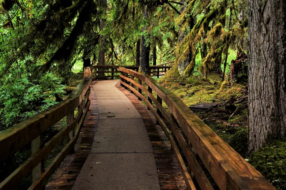
Bartlett Cove, the park's only developed area, sits in a temperate rainforest where Sitka spruce and hemlock drip with moss. The Forest Loop Trail winds through old growth on a flat boardwalk that kids can manage easily, while the longer trails push into the backcountry along the coast. Kayakers launch from Bartlett Cove for multi-day trips up the bay, camping on beaches and paddling past icebergs that calved from glaciers days before. June delivers mild weather in the low 60s and fewer cruise ships than July, though rain comes with the territory in a temperate rainforest. The park service limits the number of vessels allowed in the bay each day, which keeps the experience closer to wilderness than theme park.