8 parks with no cell service (and why that's a good thing)
Eight parks where cell service doesn't exist and you'll stop caring about it by day two
You can't avoid your phone by accident anymore. The national parks that still lack cell service do so by geography, not neglect: isolated islands, Arctic river valleys, volcanic ranges so remote that even satellite coverage fades. What these places share is distance from infrastructure and the uncommon ability to keep you present.
June arrives differently in each of these parks. In Alaska, you'll catch the midnight sun and the tail end of caribou migrations. On Isle Royale, the water begins to warm and the bugs haven't yet reached their July frenzy. In American Samoa, the dry season makes trails passable. What connects them all is the silence that arrives when you can't check email between viewpoints.
Isle Royale National Park
165 trail miles across Lake Superior / No roads, no cell towers, no shortcuts
Isle Royale makes you earn it. The ferry from Houghton takes three and a half hours, and that's assuming you booked months ahead. Once you arrive at Rock Harbor or Windigo, you're committed to a park where everything you need rides on your back. The 36 primitive campgrounds scattered across this Lake Superior island fill with backpackers who planned their routes on paper maps because GPS doesn't work here.
The wolves and moose that share this island don't care about your itinerary, and after a day on the Greenstone Ridge, neither will you.
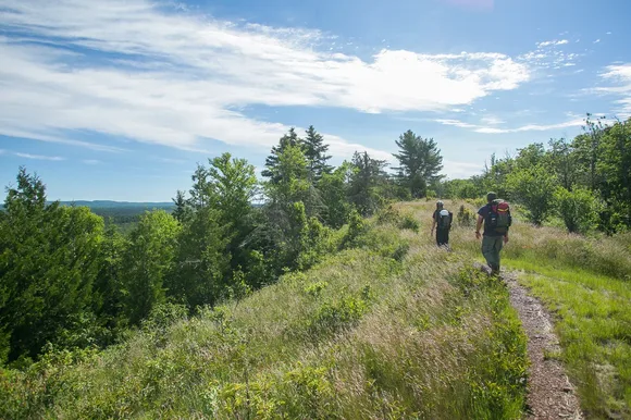
June brings comfortable hiking temperatures in the low 60s and reasonable bug pressure. The Minong Ridge Trail cuts across the island's northern edge for 28 rugged miles, while shorter loops like the Mount Franklin Trail offer views of inland lakes framed by boreal forest. You'll cross paths with maybe a dozen other hikers all day, which feels like solitude compared to most national park trails. The lack of connectivity isn't a quirk. It's structural, and it resets the pace of every conversation at the backcountry shelters.
Gates Of The Arctic National Park & Preserve
Larger than Switzerland with zero trails / Brooks Range wilderness above the Arctic Circle
Gates of the Arctic doesn't have trailheads because it doesn't have trails. The park protects an area bigger than Yellowstone, Yosemite, and Switzerland combined, and reaching any part of it requires flying into the villages of Bettles or Anaktuvuk Pass, then chartering a bush plane to drop you somewhere along the Brooks Range. Most visitors never make the trip. Those who do find tundra valleys where caribou migrations follow routes unchanged since the Pleistocene.
Navigation here means reading drainages and ridgelines, not following blazes someone painted on trees.
June brings 24-hour daylight and temperatures that might crack 60 degrees if you're lucky. The Noatak River and Alatna River corridors draw paddlers willing to commit to multi-week expeditions with no bailout points. Backpackers traverse open tundra where sightlines stretch for miles and grizzlies appear as dots moving across distant slopes. Cell service isn't just absent. It's irrelevant to the kind of travel this park demands. You prepare, you go, and you adjust based on weather and terrain you read in real time.
Katmai National Park & Preserve
North America's densest brown bear population / Brooks Falls platform puts you ten feet from salmon runs
Katmai solves the connectivity problem by making it irrelevant. The Brooks Falls viewing platforms fill with visitors watching brown bears fish for sockeye salmon so close you can hear their jaws snap shut. Most people fly in for a day trip from Anchorage, spend four hours on the platforms, and fly back. The park's size absorbs them easily. Beyond Brooks Camp, the Valley of Ten Thousand Smokes stretches across volcanic ash fields that still look barren more than a century after the Noatak eruption reshaped the drainage.
You'll watch bears catch salmon in midair and realize your phone has been in your pocket for three hours without you noticing.
June offers the best bear viewing before the July crowds arrive. Katmai Lodge and Brooks Lodge handle reservations a year in advance, but backcountry permits for coastal camping along Naknek Lake stay available. The Brooks Falls Trail covers just over a mile, making it manageable for families who can handle wooden boardwalks and staircases. Rangers lead programs that explain bear behavior and volcanic geology without needing to google anything mid-talk. The lack of cell coverage keeps the focus on what's happening in the river.
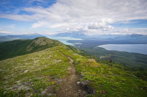
Lake Clark National Park & Preserve
Two active volcanoes / 42-mile turquoise lake / Floatplane-only access
Lake Clark sits 100 miles southwest of Anchorage, but it might as well be 1,000. No roads reach the park. Every visitor arrives by floatplane, landing on Lake Clark or one of the smaller lakes scattered across the Chigmit Mountains. Mount Redoubt and Mount Iliamna steam occasionally, reminding you that this landscape still shifts. The park protects roadless salmon streams where brown bears fish without ever learning to associate humans with food.
The turquoise of Lake Clark looks Photoshopped until you dip your hand in glacial silt cold enough to numb your fingers in seconds.
June brings long daylight and manageable weather for paddling Lake Clark's 42-mile length. The Twin Lakes Trail offers moderate hiking through tundra valleys, while more ambitious routes push toward the volcanic peaks. Port Alsworth serves as the main base, with a handful of lodges and a ranger station. Most backpackers arrange drop-offs at remote lakes, then paddle and hike for a week without seeing another person. The absence of cell service becomes obvious only when you try to call your floatplane pilot for pickup and remember you arranged the time weeks ago.
Kobuk Valley National Park
Arctic sand dunes spanning 25 square miles / Carved by Ice Age winds still blowing today
The Great Kobuk Sand Dunes rise from tundra 30 miles above the Arctic Circle, a landscape so incongruous that first-time visitors assume they've misread the map. These aren't small dunes. They cover an area larger than Manhattan, with some ridges reaching heights that rival buildings. The Kobuk River curves past the southern edge, carrying paddlers through one of the most geologically strange protected areas in the country.
Walking barefoot across Arctic sand while watching caribou migrate past spruce trees rewires your sense of what Alaska looks like.

June brings the Western Arctic caribou herd through Onion Portage, an archaeological site where humans have intercepted this migration for 10,000 years. The dunes warm quickly under 24-hour sun, making them comfortable for camping despite the latitude. Most visitors fly into Kotzebue, then charter a bush plane to the Kobuk River. From there, you paddle downstream, pull your boat onto the sand, and hike into dunes that shift position year by year. No cell service reaches this far, and satellite communication becomes your only link to weather updates and pickup coordination.
National Park of American Samoa
The only U.S. park south of the equator / Three volcanic islands protecting coral reefs and rainforest
American Samoa keeps its status as the least-visited national park for good reason: getting there requires a five-hour flight from Honolulu to Pago Pago, followed by another flight to Ofu if you want the best beaches. Once you arrive, you'll find a park that protects not just landscape but the fa'a Samoa, the traditional Samoan way of life integrated into how the park operates. Villages sit within park boundaries, and hiking trails pass through land managed by families who've lived here for generations.
Ofu Beach stretches along coral reefs so pristine that marine biologists use them as baseline data for what healthy Pacific reefs should look like.
June falls at the tail end of the dry season, making the Mount Lata Trail passable despite its steep grade through rainforest. The trail gains elevation fast, opening views across Tutuila's coastline where fruit bats hang in canopy trees. No cell service reaches most of the park, though some spots near Pago Pago pick up faint signals. The disconnect feels less noticeable here because the pace of island life already runs slower. You'll spend more time snorkeling the South Lagoon and talking with villagers than checking your phone.
Wrangell-St. Elias National Park & Preserve
Larger than Switzerland / Nine of North America's 16 highest peaks
Wrangell-St. Elias swallows other parks for scale. The Bagley Icefield alone covers more area than Rhode Island, feeding glaciers that terminate in valleys you can drive to via the McCarthy Road. Mount St. Elias rises from sea level to 18,000 feet in ten horizontal miles, creating one of the steepest elevation gains on Earth. The park's size means you can hike for weeks without retracing your steps, and most of that terrain sees fewer than a dozen visitors per year.
The Root Glacier Trail lets you walk on blue ice carved from mountains you can see from the trailhead, no technical gear required.
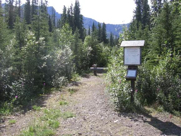
June brings stable weather for the McCarthy Road, a 60-mile gravel route that ends where the park really begins. The historic mining towns of McCarthy and Kennicott serve as base camps for day hikes and glacier treks. Cell service fades about 20 miles into the drive and doesn't return until you leave. The Kuskulana Glacier Trail and Mount Wrangell routes push into backcountry where you'll navigate by topographic map and compass because GPS units struggle with the magnetic anomalies near volcanic peaks.
North Cascades National Park
More glaciers than any Lower 48 park / Three hours from Seattle / Almost nobody here
North Cascades holds more than 300 glaciers within driving distance of a city of four million people, yet it draws fewer visitors than any major national park outside Alaska. The numbers don't make sense until you see the terrain: jagged peaks that require technical climbing, trails that gain 3,000 feet in three miles, and weather that shifts from sun to whiteout in an hour. The North Cascades Highway crosses the park from west to east, offering access to trailheads like Cascade Pass and Diablo Lake that fill on summer weekends while the backcountry stays empty.
Mount Shuksan rises so abruptly from Picture Lake that photographers have been framing the same shot for 70 years without exhausting the combinations of light and weather.
June brings snowmelt that turns waterfalls into white noise and clears the lower trails for hiking. Cell service works near the visitor centers but fades once you push into valleys like Big Beaver or Copper Ridge. The Ross Lake area offers backcountry camping accessible by boat, while trails like Heather Pass climb into alpine zones where glaciers calve into turquoise lakes. Families stick to the Rainy Lake Loop, an accessible trail that shows off the landscape without requiring stamina. Everyone else spreads across 225 trail miles that rarely see crowds.